Latitude: 52.2411 / 52°14'27"N
Longitude: 0.7172 / 0°43'1"E
OS Eastings: 585617
OS Northings: 263798
OS Grid: TL856637
Mapcode National: GBR QF0.G4V
Mapcode Global: VHKD4.DX0W
Plus Code: 9F426PR8+CV
Entry Name: 24-27, Crown Street
Listing Date: 12 July 1972
Grade: II
Source: Historic England
Source ID: 1342749
English Heritage Legacy ID: 466776
ID on this website: 101342749
Location: Bury St Edmunds, West Suffolk, IP33
County: Suffolk
District: West Suffolk
Civil Parish: Bury St Edmunds
Built-Up Area: Bury St Edmunds
Traditional County: Suffolk
Lieutenancy Area (Ceremonial County): Suffolk
Church of England Parish: Bury St Edmunds St Mary
Church of England Diocese: St.Edmundsbury and Ipswich
Tagged with: Building
BURY ST EDMUNDS
TL8563NE CROWN STREET 639-1/11/304 (East side) 12/07/72 Nos.24-27 (Consecutive)
GV II
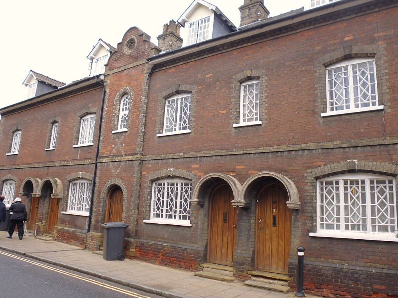
A terrace of 4 houses. In red brick with white brick dressings and slate roofs. 1839. EXTERIOR: 2 storeys and attics. 7 window range: 1- 2- and 3-light latticed metal casements in plain reveals with segmental brick arches and raised keystones. A raised brick band between the storeys. The centre part, which rises to a shaped gable, projects forward slightly with diaper-patterns to the brickwork. A semicircular-headed archway on the ground storey with a semicircular-headed window above and a circular stone panel in the gable inscribed EC 1839. Paired boarded doors up steps have linked semicircular-arched hoods on corbels. 4 gabled dormers with 2-light casement windows. 3 square shafted chimney-stacks with moulded brick caps. INTERIOR: not inspected.
Listing NGR: TL8561763798
External links are from the relevant listing authority and, where applicable, Wikidata. Wikidata IDs may be related buildings as well as this specific building. If you want to add or update a link, you will need to do so by editing the Wikidata entry.


Other nearby listed buildings