Latitude: 52.2413 / 52°14'28"N
Longitude: 0.7165 / 0°42'59"E
OS Eastings: 585567
OS Northings: 263817
OS Grid: TL855638
Mapcode National: GBR QF0.FZ0
Mapcode Global: VHKD4.CXMQ
Plus Code: 9F426PR8+GH
Entry Name: Green King Maltings
Listing Date: 30 October 1997
Grade: II
Source: Historic England
Source ID: 1031121
English Heritage Legacy ID: 466667
ID on this website: 101031121
Location: Bury St Edmunds, West Suffolk, IP33
County: Suffolk
District: West Suffolk
Civil Parish: Bury St Edmunds
Built-Up Area: Bury St Edmunds
Traditional County: Suffolk
Lieutenancy Area (Ceremonial County): Suffolk
Church of England Parish: Bury St Edmunds St Mary
Church of England Diocese: St.Edmundsbury and Ipswich
Tagged with: Building
BURY ST EDMUNDS
TL8563NE BRIDEWELL LANE 639-1/11/207 (East side) Greene King Maltings
GV II
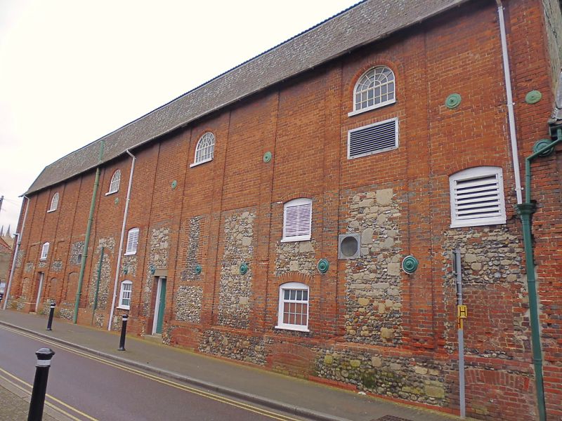
Maltings, part of the Greene King Brewery. 1846. Red brick, with an admixture of flint and stone blocks to the ground and 1st storeys. Concrete plaintiles to the mansard roof. Render and mock timbering to the south gable. EXTERIOR: 3 storeys; divided into 12 narrow bays by red brick pilasters. Fluted bargeboards to the south gable. 4 louvred window openings to the 1st storey and 4 semicircular-headed small-paned cast-iron windows to the top storey; various blocked openings. A former central entry with an arched surround is blocked by flint and stone infilling and surrounded by red bricks with blue headers which are older than the remainder of the brickwork. This, and the flint and stone on the ground and 1st storeys, indicate a possible earlier core to the building. INTERIOR not inspected.
Listing NGR: TL8556763817
External links are from the relevant listing authority and, where applicable, Wikidata. Wikidata IDs may be related buildings as well as this specific building. If you want to add or update a link, you will need to do so by editing the Wikidata entry.


Other nearby listed buildings