Approximate Location Map
Large Map »
Latitude: 51.0716 / 51°4'17"N
Longitude: 1.0863 / 1°5'10"E
OS Eastings: 616308
OS Northings: 134783
OS Grid: TR163347
Mapcode National: GBR V0L.RG2
Mapcode Global: FRA F659.10J
Plus Code: 9F3333CP+JG
Entry Name: 126 and 128, High Street
Listing Date: 21 December 1973
Grade: II
Source: Historic England
Source ID: 1344098
English Heritage Legacy ID: 175128
ID on this website: 101344098
Location: Hythe, Folkestone and Hythe, Kent, CT21
County: Kent
District: Folkestone and Hythe
Civil Parish: Hythe
Built-Up Area: Hythe
Traditional County: Kent
Lieutenancy Area (Ceremonial County): Kent
Tagged with: Building
1.
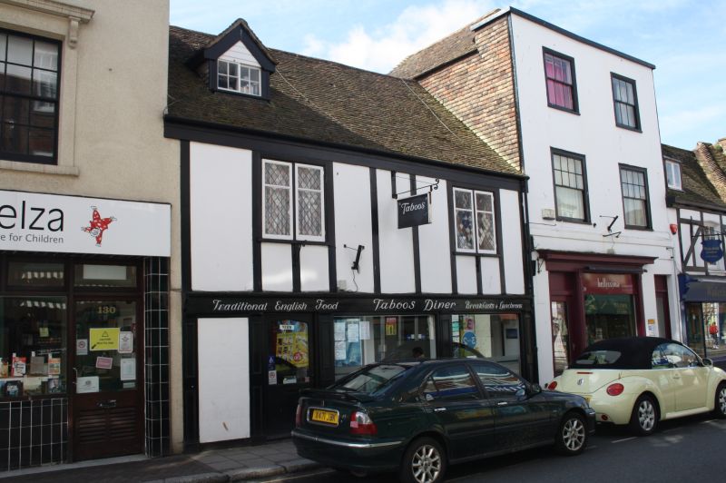
1253 HIGH STREET
(South Side)
Nos 126 and 128
TR 1634 NW 2/111
II GV
2.
Outwardly C19. 2 storeys pseudo timber-framed with plaster infiil. Tiled roof
with 1 hipped dormer 2 mullioned and transomed diamond-paned casements. Modern
shop front.
Nos 94 to 98 (even), No 102 and Nos 106 to 130 (even) form a group.
Listing NGR: TR1631034780
External links are from the relevant listing authority and, where applicable, Wikidata. Wikidata IDs may be related buildings as well as this specific building. If you want to add or update a link, you will need to do so by editing the Wikidata entry.


Other nearby listed buildings
