Approximate Location Map
Large Map »
Latitude: 51.1839 / 51°11'2"N
Longitude: -3.4457 / 3°26'44"W
OS Eastings: 299053
OS Northings: 143737
OS Grid: SS990437
Mapcode National: GBR LK.5QX0
Mapcode Global: VH6GM.7H8R
Plus Code: 9C3R5HM3+HP
Entry Name: Stone Archway Adjoining Tithe Barn to the North
Listing Date: 4 August 1983
Grade: II
Source: Historic England
Source ID: 1345580
English Heritage Legacy ID: 264708
ID on this website: 101345580
Location: Dunster, Somerset, TA24
County: Somerset
District: Somerset West and Taunton
Civil Parish: Dunster
Built-Up Area: Dunster
Traditional County: Somerset
Lieutenancy Area (Ceremonial County): Somerset
Tagged with: Architectural structure
1.
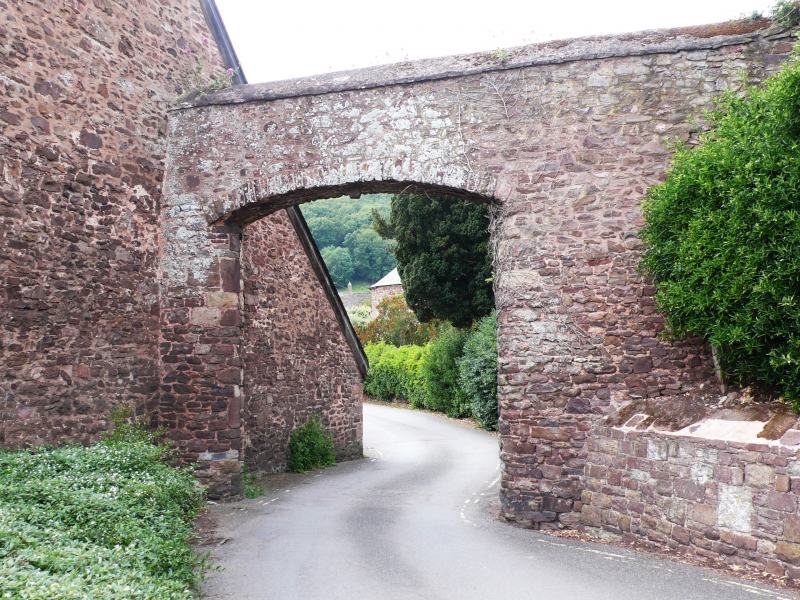
5366 DUNSTER PRIORY GREEN
Stone Archway adjoining Tithe Barn
to the north
SS 9843-9943 4/76
II GV
2.
Early 19th century. Stone built archway spanning Priory Green. About 12 feet high.
Segmental arch, rubble stone voussoirs, rounded reveals with rebates and iron hinges
for gates.
Listing NGR: SS9905343737
External links are from the relevant listing authority and, where applicable, Wikidata. Wikidata IDs may be related buildings as well as this specific building. If you want to add or update a link, you will need to do so by editing the Wikidata entry.


Other nearby listed buildings
