Latitude: 51.1833 / 51°10'59"N
Longitude: -3.4466 / 3°26'47"W
OS Eastings: 298991
OS Northings: 143664
OS Grid: SS989436
Mapcode National: GBR LK.5QPN
Mapcode Global: VH6GM.6JS8
Plus Code: 9C3R5HM3+89
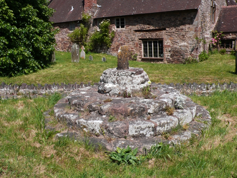
Entry Name: Cross in Churchyard 20 Metres West of Church
Listing Date: 4 August 1983
Grade: II
Source: Historic England
Source ID: 1345610
English Heritage Legacy ID: 264661
ID on this website: 101345610
Location: St George's Church, Dunster, Somerset, TA24
County: Somerset
District: Somerset West and Taunton
Civil Parish: Dunster
Built-Up Area: Dunster
Traditional County: Somerset
Lieutenancy Area (Ceremonial County): Somerset
1.
5366 DUNSTER CHURCH STREET
Cross in Churchyard
ss 9843-9943 4/29 20 metres West of church
II GV
2.
Remains of 15th century stone cross. Stump with round shaft in octagonal socket on
round base, three steps.
Listing NGR: SS9899543662
External links are from the relevant listing authority and, where applicable, Wikidata. Wikidata IDs may be related buildings as well as this specific building. If you want to add or update a link, you will need to do so by editing the Wikidata entry.


Other nearby listed buildings