Latitude: 54.0683 / 54°4'5"N
Longitude: -0.5831 / 0°34'59"W
OS Eastings: 492824
OS Northings: 464520
OS Grid: SE928645
Mapcode National: GBR SPCD.KD
Mapcode Global: WHGD3.00MJ
Plus Code: 9C6X3C98+8Q
Entry Name: Walls, Gatepiers, Railings and Gates to Sledmere House Extending from South-Westernmost End to Stables
Listing Date: 7 September 1987
Grade: II
Source: Historic England
Source ID: 1346447
English Heritage Legacy ID: 167849
ID on this website: 101346447
Location: Sledmere, East Riding of Yorkshire, YO25
County: East Riding of Yorkshire
Civil Parish: Sledmere
Traditional County: Yorkshire
Lieutenancy Area (Ceremonial County): East Riding of Yorkshire
Church of England Parish: Sledmere St Mary
Church of England Diocese: York
Tagged with: Wall
SLEDMERE MAIN STREET SE 9264-9364 (south-east side)
17/39 Walls, gate piers, railings and gates to Sledmere House extending from south-westernmost end to stables
GV II
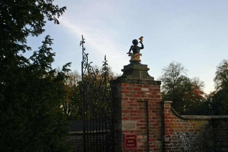
Walls, gate piers, railings and gates. Gates abutting stables (qv) are c1700 brought from Venice during the C19, otherwise gates are of 1813 by Watson and Pritchett of York for Sir Mark Masterman Sykes, 3rd Baronet, with late C18 walls for Sir Christopher Sykes, 2nd Baronet, with later additions and alterations including those of early mid C20 for Sir Richard Sykes, 7th Baronet. Walls of pinkish-red brick in English garden wall bond with ashlar and moulded tile copings. Wrought-iron gates. 2.5 metres high. From south-west: square end pier with peaked ashlar coping. Wall with tile copings extends for approximately 25 metres to C20 west entrance with square end piers surmounted by artificial stone sphinxes and with ramped, ashlar coped walls, curved on plan, to artificial stone ornamental pier surmounted by draped urns. Between are double gates and railings; with 4 levels of rails, lance finials and curvy dogbars. Gates are flanked by ornamental wrought-iron piers surmounted by tritons and have arched braces. Wall continues for approximately 45 metres with tile copings to entrance to St Mary's Churchyard. Similar double gates with inserted pedestrian gate between ornamental wrought-iron piers surmounted by tritons. Wall continues for approximately 35 metres to similar pier. This stretch forms north wall of walled paddock approximately square on plan. From pier, wall returns to entrance to stableyard. Gate piers square on plan, rebuilt but surmounted by similar wrought-iron tritons. Ornamental double gates between have scroll and ribbon motif to lower part, then bars with scrolls to sides and with ornamental overthrow. Here wall abutts rear of stables and carriage house (qv).
Listing NGR: SE9282464520
External links are from the relevant listing authority and, where applicable, Wikidata. Wikidata IDs may be related buildings as well as this specific building. If you want to add or update a link, you will need to do so by editing the Wikidata entry.


Other nearby listed buildings