Latitude: 51.7492 / 51°44'57"N
Longitude: -0.0116 / 0°0'41"W
OS Eastings: 537363
OS Northings: 207481
OS Grid: TL373074
Mapcode National: GBR KCD.9WY
Mapcode Global: VHGPW.R98D
Plus Code: 9C3XPXXQ+M9
Entry Name: Pumping Station (Thames Water)
Listing Date: 8 November 1983
Grade: II
Source: Historic England
Source ID: 1348385
English Heritage Legacy ID: 157407
ID on this website: 101348385
Location: Spitalbrook, Broxbourne, Hertfordshire, EN10
County: Hertfordshire
District: Broxbourne
Electoral Ward/Division: Broxbourne and Hoddesdon South
Parish: Non Civil Parish
Built-Up Area: Hoddesdon
Traditional County: Hertfordshire
Lieutenancy Area (Ceremonial County): Hertfordshire
Church of England Parish: Broxbourne with Wormley
Church of England Diocese: St.Albans
Tagged with: Pump
1. 5251 HODDESDON CHURCHFIELDS (east side) Broxbourne Pumping Station (Thames Water) TL 3707 8/89
II
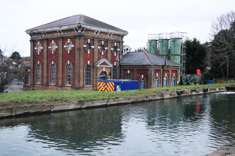
2. 1887. Yellow stock and red brick, gault brick and stone dressings slate pyramid roof. Square main block has 4 pilasters each side giving identical bays with round-headed ground floor and circular upper level windows. Raised brick surrounds, stone key blocks, iron glazing bars. Stone cornice with paired brackets. E elevation has central, projecting, stone-pedimented doorcase. Single storey extension on N: 7 bays, 3 round-arched ground floor openings. Similar extension on W, 3 bays. (Pevsner 1977).
Listing NGR: TL3736207482
External links are from the relevant listing authority and, where applicable, Wikidata. Wikidata IDs may be related buildings as well as this specific building. If you want to add or update a link, you will need to do so by editing the Wikidata entry.


Other nearby listed buildings