Latitude: 52.2169 / 52°13'0"N
Longitude: -2.8938 / 2°53'37"W
OS Eastings: 339033
OS Northings: 258009
OS Grid: SO390580
Mapcode National: GBR FB.2JTP
Mapcode Global: VH77B.SJJW
Plus Code: 9C4V6484+QF
Entry Name: Court House Farmhouse
Listing Date: 19 August 1953
Grade: II
Source: Historic England
Source ID: 1349911
English Heritage Legacy ID: 150326
ID on this website: 101349911
Location: Pembridge, County of Herefordshire, HR6
County: County of Herefordshire
Civil Parish: Pembridge
Built-Up Area: Pembridge
Traditional County: Herefordshire
Lieutenancy Area (Ceremonial County): Herefordshire
Church of England Parish: Pembridge with Moorcourt
Church of England Diocese: Hereford
Tagged with: Farmhouse
PEMBRIDGE CP MARKET PLACE SO 3858 - 3958
10/68 Court House Farmhouse
19.8.53
GV II
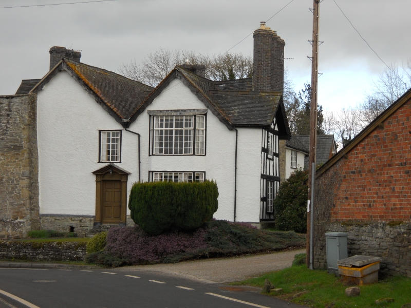
Farmhouse. C17, altered during C18 and further C20 alterations. Square panelled timber-framing (revealed to south front) with part wattle-and-daub and part painted brick infill on sandstone rubble plinth and external stacks with rebuilt diagonal brick shafts; part tiled and part Welsh slate roofs. Irregular plan, generally rectangular with three gables to north, two to east and west and one to south front; lateral stacks and axial stack. Two storeys and cellars. West front: blocked stack to left, one 2-light multi-paned C20 casement window to left; two-storey canted bay window with multi-paned C20 casement windows to right of doorway with open pedimented surround. Semi- circular headed doorhead with decorative fanlight, 6-panelled door. Moated site. (RCHM, Vol III, p 163, item 5).
Listing NGR: SO3903358009
External links are from the relevant listing authority and, where applicable, Wikidata. Wikidata IDs may be related buildings as well as this specific building. If you want to add or update a link, you will need to do so by editing the Wikidata entry.


Other nearby listed buildings