Latitude: 50.9165 / 50°54'59"N
Longitude: 0.4849 / 0°29'5"E
OS Eastings: 574770
OS Northings: 115941
OS Grid: TQ747159
Mapcode National: GBR PWF.HFL
Mapcode Global: FRA C6XP.6RF
Plus Code: 9F22WF8M+HX
Entry Name: 67 and 67A, High Street
Listing Date: 13 May 1987
Grade: II
Source: Historic England
Source ID: 1352849
English Heritage Legacy ID: 292164
ID on this website: 101352849
Location: Battle, Rother, East Sussex, TN33
County: East Sussex
District: Rother
Civil Parish: Battle
Built-Up Area: Battle
Traditional County: Sussex
Lieutenancy Area (Ceremonial County): East Sussex
Church of England Parish: Battle St Mary the Virgin
Church of England Diocese: Chichester
Tagged with: Building
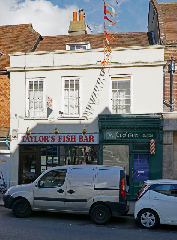
TQ 7415-7515 BATTLE HIGH STREET
(north east side)
41/31 Nos 67 and 67A
GV II
One building. C17 or earlier timber-framed building with the timbering exposed
in the side wall but refronted with stucco in the C18. Cornice and glazing bars
intact on first floor. Modern shop fronts. Two storeys and attic. Three windows.
One dormer.
Listing NGR: TQ7477015945
External links are from the relevant listing authority and, where applicable, Wikidata. Wikidata IDs may be related buildings as well as this specific building. If you want to add or update a link, you will need to do so by editing the Wikidata entry.


Other nearby listed buildings