Latitude: 50.8331 / 50°49'59"N
Longitude: -0.2763 / 0°16'34"W
OS Eastings: 521482
OS Northings: 105148
OS Grid: TQ214051
Mapcode National: GBR HMF.NZ6
Mapcode Global: FRA B69W.XW7
Plus Code: 9C2XRPMF+7F
Entry Name: St John's
Listing Date: 29 September 1972
Last Amended: 27 July 1984
Grade: II
Source: Historic England
Source ID: 1353758
English Heritage Legacy ID: 297297
ID on this website: 101353758
Location: Shoreham-by-Sea, Adur, West Sussex, BN43
County: West Sussex
District: Adur
Electoral Ward/Division: St Mary's
Parish: Non Civil Parish
Built-Up Area: Shoreham-by-Sea
Traditional County: Sussex
Lieutenancy Area (Ceremonial County): West Sussex
Church of England Parish: New Shoreham St Mary de Haura
Church of England Diocese: Chichester
Tagged with: Architectural structure
In the entry for: SHOREHAM-BY-SEA JOHN STREET (east side) 6/81
No 34 (St John's) The item shall be changed to read: JOHN STREET (east side) No 34 (St John's) (formerly listed as No 34 (St John's) outbuilding to North of No 34 (St John's) walls adjoining No 34 (St John's) on each side) The former listing date shall be added to read: 29/9/72
------------------------------------
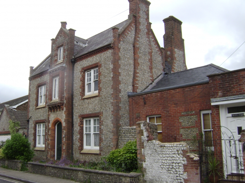
SHOREHAM-BY-SEA JOHN STREET TQ 2105 SW 6/81 (east side) No 34 (St John's) GV II House. Circa 1860. Coursed cobblestone with red brick quoins and dressings. Toothed red brick eaves cornice to slate roof with gable-parapets and end stacks. Two storeys with 3 storey projecting porch. Three bays, symmetrical, with double sashes, glazing bars only in upper blades. Projecting shallow oriel corbelled out on first floor of porch with tall casements. Central entrance with panelled doors in hollow-chamfered pointed-arched surround. Garage to left, C20 in same style (not listed).
Listing NGR: TQ2148405145
External links are from the relevant listing authority and, where applicable, Wikidata. Wikidata IDs may be related buildings as well as this specific building. If you want to add or update a link, you will need to do so by editing the Wikidata entry.


Other nearby listed buildings