Latitude: 53.4808 / 53°28'50"N
Longitude: -2.1001 / 2°6'0"W
OS Eastings: 393451
OS Northings: 398235
OS Grid: SJ934982
Mapcode National: GBR FXS5.3Y
Mapcode Global: WHB9J.QR4X
Plus Code: 9C5VFVJX+8W
Entry Name: Park Parade Railway Viaduct, Western Crossing of the River Tame
Listing Date: 6 February 1986
Grade: II
Source: Historic England
Source ID: 1356420
English Heritage Legacy ID: 212460
ID on this website: 101356420
Location: Guide Bridge, Tameside, Greater Manchester, SK16
County: Tameside
Electoral Ward/Division: St Peter's
Parish: Non Civil Parish
Built-Up Area: Ashton-under-Lyne
Traditional County: Cheshire
Lieutenancy Area (Ceremonial County): Greater Manchester
Church of England Parish: Ashton-under-Lyne The Good Shepherd
Church of England Diocese: Manchester
The asset was previously Listed twice also under List entry 1261099. This entry was removed from the List on 19 January 2018.
SJ 99 NW
3/4
DUKINFIELD
DUKINFIELD
Park Parade Railway Viaduct, western crossing of the River Tame
II
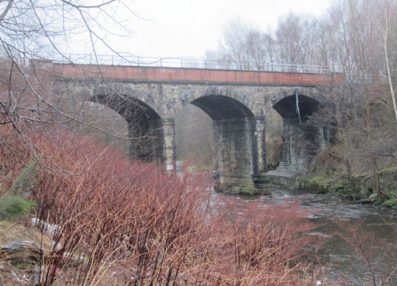
Railway viaduct over the River Tame. c.1845. Rock-faced
stone and brick. 3 segmental arches. Each arch has
rusticated voussoirs and is supported on a square pier with
shaped cutwater and springing band. The brick parapet has
an ashlar band and coping and square terminating piers.
Listing NGR: SJ 93451 98235


Other nearby listed buildings