Approximate Location Map
Large Map »
Latitude: 51.3158 / 51°18'57"N
Longitude: 0.8907 / 0°53'26"E
OS Eastings: 601539
OS Northings: 161382
OS Grid: TR015613
Mapcode National: GBR SW3.J09
Mapcode Global: VHKJW.D663
Plus Code: 9F328V8R+87
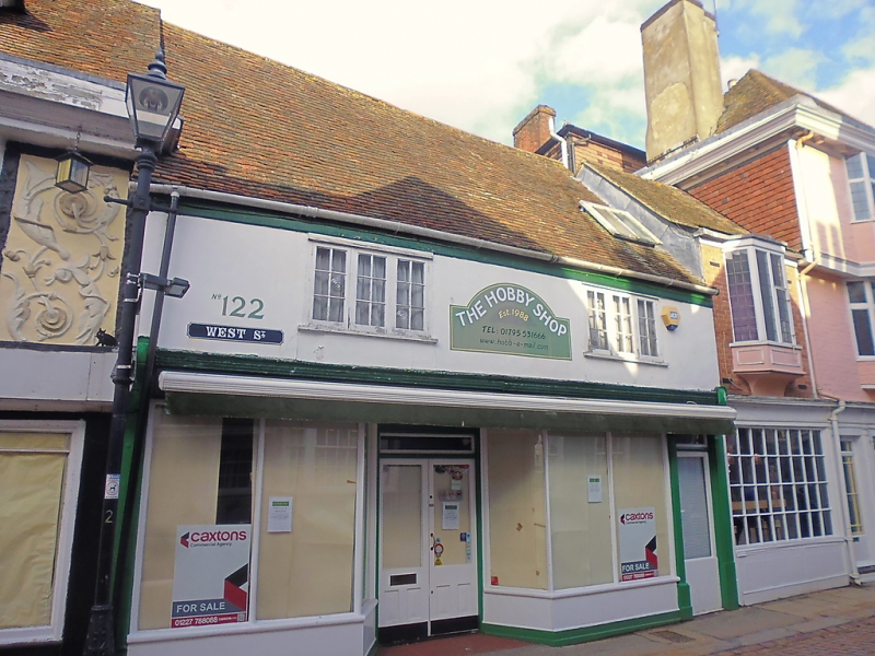
Entry Name: 122, West Street
Listing Date: 29 July 1950
Grade: II
Source: Historic England
Source ID: 1356691
English Heritage Legacy ID: 438565
ID on this website: 101356691
Location: Faversham, Swale, Kent, ME13
County: Kent
District: Swale
Civil Parish: Faversham
Built-Up Area: Faversham
Traditional County: Kent
Lieutenancy Area (Ceremonial County): Kent
Tagged with: Building
WEST STREET
1.
l103 (North Side)
------------
No 122
TR 0161 SE 3/140 29.7.5O.
II GV
2.
Cl8 front to C16 building behind facade. 2 storeys. 2 windows. Stuccoed
Tiled roof. Modern shop window. Pargetting on an inside wall upstairs and
the date 1706.
Nos 121 to 123 (consec) form a group with No 1 Market Place
Listing NGR: TR0154161381
External links are from the relevant listing authority and, where applicable, Wikidata. Wikidata IDs may be related buildings as well as this specific building. If you want to add or update a link, you will need to do so by editing the Wikidata entry.


Other nearby listed buildings
