Approximate Location Map
Large Map »
Latitude: 51.3158 / 51°18'56"N
Longitude: 0.8905 / 0°53'25"E
OS Eastings: 601525
OS Northings: 161372
OS Grid: TR015613
Mapcode National: GBR SW3.HXV
Mapcode Global: VHKJW.D635
Plus Code: 9F328V8R+85
Entry Name: 2, West Street
Listing Date: 3 August 1972
Grade: II
Source: Historic England
Source ID: 1074907
English Heritage Legacy ID: 438525
ID on this website: 101074907
Location: Faversham, Swale, Kent, ME13
County: Kent
District: Swale
Civil Parish: Faversham
Built-Up Area: Faversham
Traditional County: Kent
Lieutenancy Area (Ceremonial County): Kent
Tagged with: Building
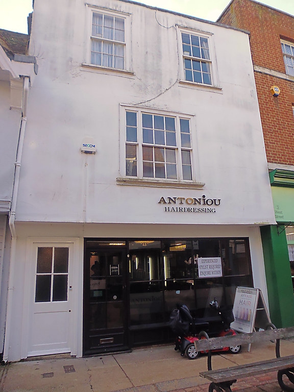
WEST STREET
1.
ll03 (South Side)
------------
No 2
TR 0161 SE 3/104
II GV
2.
Cl8. 3 storeys. 1 window. Fronted with roughcast. Parapet.
Glazing bars intact above ground floor. Modern shop front.
Nos 1 and 2 and Nos 4 to 12 (consec) form a group with the Nos 14 to 16 (consec)
The Market Place.
Listing NGR: TR0152461370
External links are from the relevant listing authority and, where applicable, Wikidata. Wikidata IDs may be related buildings as well as this specific building. If you want to add or update a link, you will need to do so by editing the Wikidata entry.


Other nearby listed buildings
