Approximate Location Map
Large Map »
Latitude: 51.3159 / 51°18'57"N
Longitude: 0.8904 / 0°53'25"E
OS Eastings: 601523
OS Northings: 161392
OS Grid: TR015613
Mapcode National: GBR SW3.HXS
Mapcode Global: VHKJW.D631
Plus Code: 9F328V8R+95
Entry Name: 119, West Street
Listing Date: 3 August 1972
Grade: II
Source: Historic England
Source ID: 1356690
English Heritage Legacy ID: 438563
ID on this website: 101356690
Location: Faversham, Swale, Kent, ME13
County: Kent
District: Swale
Civil Parish: Faversham
Built-Up Area: Faversham
Traditional County: Kent
Lieutenancy Area (Ceremonial County): Kent
Tagged with: Building
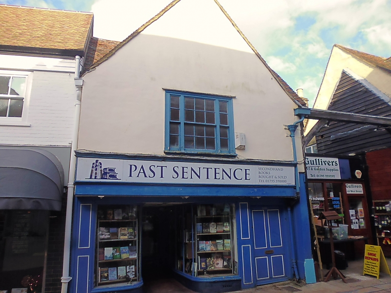
WEST STREET
1.
1103 (North Side)
------------
No 119
TR 0161 SE 3/138
II
2.
C16 timber-framed house refronted with plaster, the ground floor underbuilt.
Gable. Sash window on 1st floor with glazing bars intact. Modern shop
front. 2 storeys. 1 window.
Listing NGR: TR0152561396
External links are from the relevant listing authority and, where applicable, Wikidata. Wikidata IDs may be related buildings as well as this specific building. If you want to add or update a link, you will need to do so by editing the Wikidata entry.


Other nearby listed buildings
