Latitude: 51.5009 / 51°30'3"N
Longitude: -0.1281 / 0°7'41"W
OS Eastings: 530028
OS Northings: 179659
OS Grid: TQ300796
Mapcode National: GBR HJ.D4
Mapcode Global: VHGQZ.QJNR
Plus Code: 9C3XGV2C+9Q
Entry Name: Royal Institution of Chartered Surveyors the Royal Institution of Chartered Surveyors
Listing Date: 1 December 1987
Grade: II
Source: Historic England
Source ID: 1357063
English Heritage Legacy ID: 209883
ID on this website: 101357063
Location: Westminster, London, SW1P
County: London
District: City of Westminster
Electoral Ward/Division: St James's
Parish: Non Civil Parish
Built-Up Area: City of Westminster
Traditional County: Middlesex
Lieutenancy Area (Ceremonial County): Greater London
Church of England Parish: St Matthew Westminster
Church of England Diocese: London
Tagged with: Office building
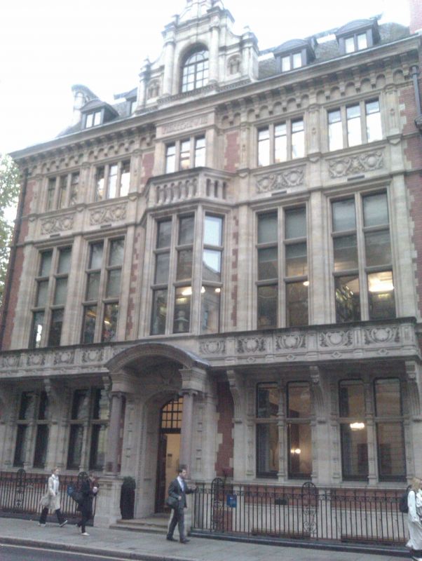
TQ 30879 NW CITY OF WESTMINSTER GREAT GEORGE STREET, SW1 92/33 Royal Institution of Chartered Surveyors G.V. II Institution headquarters. 1896-98 by Alfred Waterhouse with additions by his son Paul. Warm red brick with plenty of stone dressings, slate roofs. Waterhouse's personal version of Jacobean mixed with Flemish Renaissance and Gothic verticality. 3 tall storeys, basement and attic, the rear hall range to Little George Street and Parliament Square of 2 tall storeys and attic. Symmetrical 5-window wide entrance front. Central granite columned segmental corniced porch. Ground floor windows mullioned and transomed and framed by panelled pilasters; very tall 1st floor mullioned windows with 2 transoms, triple light 2nd floor windows with strapwork panelled aprons. 1st floor stone balcony; prominent crowning cornice surmounted over centre by elaborated, pilastered "Venetian" dormer. The east gable end enriched with stone bandings and crowned by ornate chimney stack. The hall range is linked by 2 bays of cross mullioned windows with gable attics and a recessed bay with lofty mullioned-transomed stairlights, the hall with 3 tall semicircular arched windows; quadrant south east corner.
Listing NGR: TQ3002879659
External links are from the relevant listing authority and, where applicable, Wikidata. Wikidata IDs may be related buildings as well as this specific building. If you want to add or update a link, you will need to do so by editing the Wikidata entry.


Other nearby listed buildings