Latitude: 51.6516 / 51°39'5"N
Longitude: -0.1492 / 0°8'57"W
OS Eastings: 528138
OS Northings: 196374
OS Grid: TQ281963
Mapcode National: GBR DN.H37
Mapcode Global: VHGQ6.CRH8
Plus Code: 9C3XMV22+J8
Entry Name: Cockfosters London Regional Transport Station Including Platforms and Platform Canopies
Listing Date: 26 May 1987
Grade: II
Source: Historic England
Source ID: 1358718
English Heritage Legacy ID: 200811
Also known as: Cockfosters Underground station
Cockfosters station
ID on this website: 101358718
Location: Cockfosters, Enfield, London, EN4
County: London
District: Enfield
Electoral Ward/Division: Cockfosters
Parish: Non Civil Parish
Built-Up Area: Enfield
Traditional County: Middlesex
Lieutenancy Area (Ceremonial County): Greater London
Church of England Parish: Christ Church Cockfosters
Church of England Diocese: London
Tagged with: Modern architecture Railway terminus London Underground station Station located on surface
1. 4411 COCKFOSTERS ROAD (East Side) Cockfosters LRT Station including platforms TQ 29 NE 19/1000 and platform canopies II
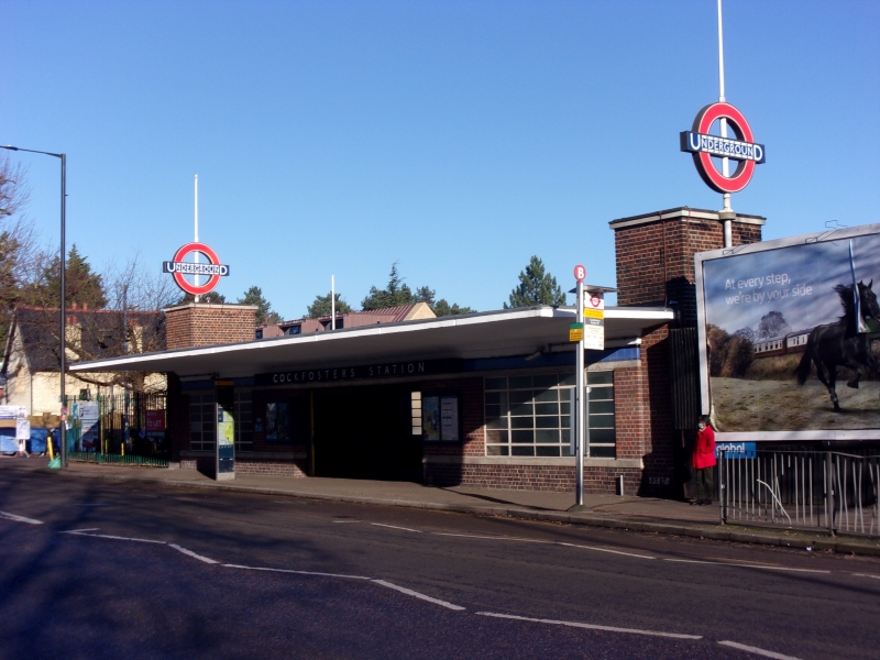
2. London Underground Station. 1933. Designed by Charles Holden. Brick and concrete entrance facades, with concrete framed train shed and booking hall. Flat roof. Main facade of 1 storey, long and low, with central square headed entrance and horizontal windows to either side with horizontal panes and metal glazing bars. End towerlets with London Underground sign finials. Cantilevered canopy over whole width. 'Prow' shaped booking hall. Train shed to rear with alternating wide and narrow bays to concrete frame, which is canted inwards above platform canopies to form a clerestory above the central track. Original light fittings, signs, etc.
Listing NGR: TQ2813896374
External links are from the relevant listing authority and, where applicable, Wikidata. Wikidata IDs may be related buildings as well as this specific building. If you want to add or update a link, you will need to do so by editing the Wikidata entry.


Other nearby listed buildings