Approximate Location Map
Large Map »
Latitude: 51.4171 / 51°25'1"N
Longitude: -0.0803 / 0°4'49"W
OS Eastings: 533587
OS Northings: 170425
OS Grid: TQ335704
Mapcode National: GBR HN.GFN
Mapcode Global: VHGRD.KND0
Plus Code: 9C3XCW89+RV
Entry Name: 11-25, Belvedere Road Se 19
Listing Date: 29 June 1973
Grade: II
Source: Historic England
Source ID: 1359371
English Heritage Legacy ID: 358338
ID on this website: 101359371
Location: Norwood New Town, Bromley, London, SE19
County: London
District: Bromley
Electoral Ward/Division: Crystal Palace
Parish: Non Civil Parish
Built-Up Area: Bromley
Traditional County: Surrey
Lieutenancy Area (Ceremonial County): Greater London
Church of England Parish: Anerley Christ Church and St Paul
Church of England Diocese: Rochester
Tagged with: Building
BELVEDERE ROAD
1,
UPPER NORWOOD SE 19
(North Side)
Nos 11 to 25 (odd)
TQ 37 SW 4/224
II GV
2.
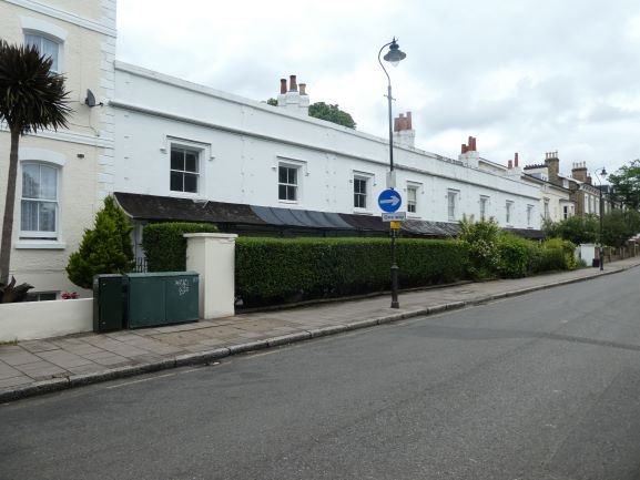
A row of almshouses circa 1850. 2 storeys stuccoed with long and short quoins
between each house. Stone parapet and dropped eaves cornice. 1 sash to each
with hood moulding. Verticals only. Cast iron verandah with hood. Simple
doorcases.
Nos 11 to 25 (odd) form a grade II group.
Listing NGR: TQ3358770425
External links are from the relevant listing authority and, where applicable, Wikidata. Wikidata IDs may be related buildings as well as this specific building. If you want to add or update a link, you will need to do so by editing the Wikidata entry.


Other nearby listed buildings
