Approximate Location Map
Large Map »
Latitude: 51.3159 / 51°18'57"N
Longitude: 0.8902 / 0°53'24"E
OS Eastings: 601506
OS Northings: 161382
OS Grid: TR015613
Mapcode National: GBR SW3.HVM
Mapcode Global: VHKJW.C6Z3
Plus Code: 9F328V8R+83
Entry Name: 6, West Street
Listing Date: 3 August 1972
Grade: II
Source: Historic England
Source ID: 1360993
English Heritage Legacy ID: 438527
ID on this website: 101360993
Location: Faversham, Swale, Kent, ME13
County: Kent
District: Swale
Civil Parish: Faversham
Built-Up Area: Faversham
Traditional County: Kent
Lieutenancy Area (Ceremonial County): Kent
Tagged with: Building
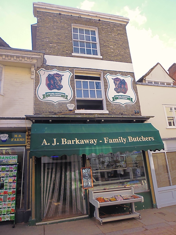
WEST STREET
1.
1103 (South Side)
------------
No 6
TR 0l6l SE 3/106
II GV
2.
Circa l830 front to C16 building. 3 storeys. 1 window. Dirty white
brick. Cornice and parapet. Former contemporary shop front, consisting
of 6 detachable wooden shutters, has been replaced by a modern plate-
glass shop front and doorway with deep fascia; C19 flat hood on
brackets over.
Nos 1 and 2 and Nos 4 to 12 (consec) form a group with Nos 14 to 16 (consec)
The Market Place.
Listing NGR: TR0150661382
External links are from the relevant listing authority and, where applicable, Wikidata. Wikidata IDs may be related buildings as well as this specific building. If you want to add or update a link, you will need to do so by editing the Wikidata entry.


Other nearby listed buildings
