Latitude: 52.6726 / 52°40'21"N
Longitude: -0.7257 / 0°43'32"W
OS Eastings: 486263
OS Northings: 309085
OS Grid: SK862090
Mapcode National: GBR CRL.HC6
Mapcode Global: WHFKN.T2MY
Plus Code: 9C4XM7FF+2P
Entry Name: The Odd House Public House
Listing Date: 24 November 1971
Grade: II
Source: Historic England
Source ID: 1361750
English Heritage Legacy ID: 186440
ID on this website: 101361750
Location: Oakham, Rutland, LE15
County: Rutland
Civil Parish: Oakham
Built-Up Area: Oakham
Traditional County: Rutland
Lieutenancy Area (Ceremonial County): Rutland
Church of England Parish: Oakham All Saints
Church of England Diocese: Peterborough
Tagged with: Pub
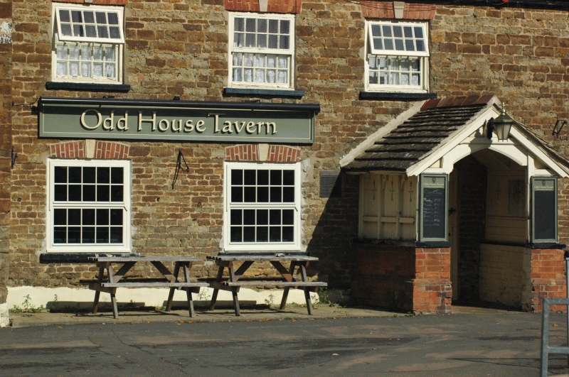
ASHWELL ROAD 1. 1469 The Odd House SK 8609 4/l23 Public House II 2. Probably originally a farm. Coursed rubble, stone slate roof. Brick chimney with cornice. Wood eaves cornice. 4 windows, brick flat arches with stucco keystones, hung sashes, glazing bars. Modern wood and brick porch with stone slate roof over doorway with segmental brick arch with keystone, modern door. To left continuing wing breaks forward slightly with 3 similar windows, but 2 are sliding sashes and one is a hung sash set in a former doorway. Stone slate roof.
Listing NGR: SK8626309085
External links are from the relevant listing authority and, where applicable, Wikidata. Wikidata IDs may be related buildings as well as this specific building. If you want to add or update a link, you will need to do so by editing the Wikidata entry.


Other nearby listed buildings