Approximate Location Map
Large Map »
Latitude: 51.2747 / 51°16'28"N
Longitude: 0.3099 / 0°18'35"E
OS Eastings: 561220
OS Northings: 155372
OS Grid: TQ612553
Mapcode National: GBR NPM.15L
Mapcode Global: VHHPV.B765
Plus Code: 9F3278F5+VX
Entry Name: Claygate House
Listing Date: 3 May 1984
Grade: II
Source: Historic England
Source ID: 1362034
English Heritage Legacy ID: 357382
ID on this website: 101362034
Location: Claygate Cross, Tonbridge and Malling, Kent, TN15
County: Kent
District: Tonbridge and Malling
Civil Parish: Plaxtol
Built-Up Area: Crouch
Traditional County: Kent
Lieutenancy Area (Ceremonial County): Kent
Church of England Parish: Plaxtol
Church of England Diocese: Rochester
Tagged with: House
TQ 65 NW PLAXTOL WINFIELD LANE
2/28 (north side)
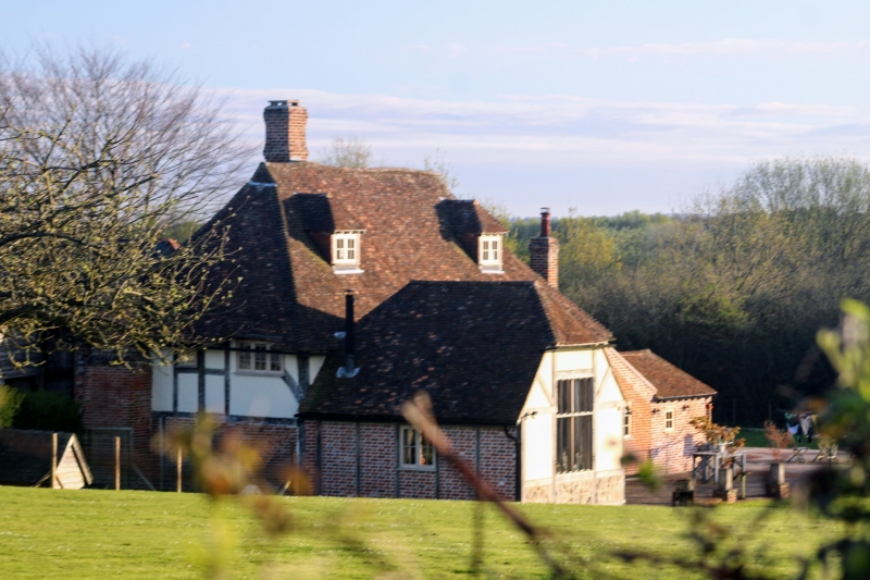
Claygate House
II
Farmhouse. C15 hall-house, much altered. Painted brick, with jetty to left
underbuilt in rubble stone. Exposed framing above. Steep hipped tiled roof with
gablets, central ridge stack and east end stack. Two storeys, 3 windows, C18 and CL9
hinged and sliding casements. Panelled door with gabled hood.
Listing NGR: TQ6122055372
External links are from the relevant listing authority and, where applicable, Wikidata. Wikidata IDs may be related buildings as well as this specific building. If you want to add or update a link, you will need to do so by editing the Wikidata entry.


Other nearby listed buildings
