Approximate Location Map
Large Map »
Latitude: 53.7058 / 53°42'20"N
Longitude: -2.5168 / 2°31'0"W
OS Eastings: 365983
OS Northings: 423388
OS Grid: SD659233
Mapcode National: GBR BTVL.X9
Mapcode Global: WH977.93SW
Plus Code: 9C5VPF4M+87
Entry Name: Sundial Circa 10 Metres West of St Stephen's Old School in St Stephen's Churchyard
Listing Date: 27 September 1984
Grade: II
Source: Historic England
Source ID: 1362160
English Heritage Legacy ID: 184730
ID on this website: 101362160
Location: St Stephen's Church, Tockholes, Blackburn with Darwen, Lancashire, BB3
County: Blackburn with Darwen
Civil Parish: Tockholes
Traditional County: Lancashire
Lieutenancy Area (Ceremonial County): Lancashire
Church of England Parish: Darwen St Cuthbert with Tockholes
Church of England Diocese: Blackburn
Tagged with: Sundial
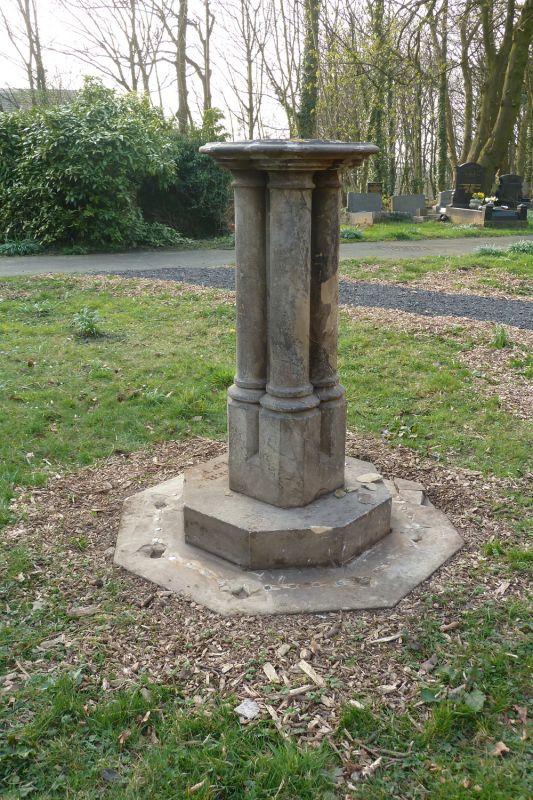
SD 62 SE TOCKHOLES CHAPELS LANE
4/57 Sundial c.10 metres west of
- St. Stephen's Old School, in
St. Stephen's churchyard
GV II
Sundial, probably C19. Sandstone. Octagonal base with short spear-headed
railings surrounding pedestal of 4 clustered colonnettes supporting a circular
table (plate and gnomon missing). Base lettered "G. Thornber sculpt."
Listing NGR: SD6598323388
External links are from the relevant listing authority and, where applicable, Wikidata. Wikidata IDs may be related buildings as well as this specific building. If you want to add or update a link, you will need to do so by editing the Wikidata entry.


Other nearby listed buildings
