Approximate Location Map
Large Map »
Latitude: 54.1955 / 54°11'43"N
Longitude: -2.586 / 2°35'9"W
OS Eastings: 361867
OS Northings: 477910
OS Grid: SD618779
Mapcode National: GBR BMCX.YS
Mapcode Global: WH94P.7TV0
Plus Code: 9C6V5CW7+6J
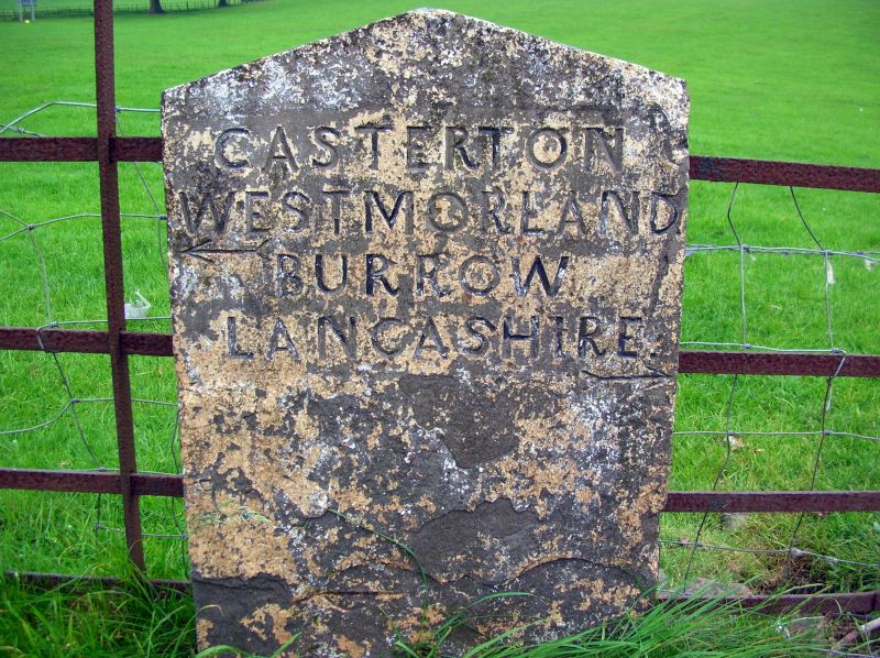
Entry Name: County Boundary Stone
Listing Date: 4 December 1985
Grade: II
Source: Historic England
Source ID: 1362520
English Heritage Legacy ID: 182349
ID on this website: 101362520
Location: Lancaster, Lancashire, LA6
County: Lancashire
District: Lancaster
Civil Parish: Burrow-with-Burrow
Traditional County: Westmorland
Lieutenancy Area (Ceremonial County): Lancashire
Church of England Parish: Tunstall St John the Baptist and Melling St Wilfred and Leck St Peter
Church of England Diocese: Blackburn
Tagged with: Architectural structure Boundary marker
This asset was previously listed twice also under List entry 1335934. This entry was removed from the List on 15/07/2015.
SD 67 NW
2/55
BURROW-WITH-BURROW
A683
County Boundary Stone
II
Boundary stone, probably early C19th. Comprises an upright sandstone flag
with a pitched top. Face inscribed: 'CASTERTON WESTMORLAND. BURROW
LANCASHIRE.' Part of this boundary stone is in Casterton C.P., in the
County of Cumbria (q.v.)
Listing NGR: SD6186777910
External links are from the relevant listing authority and, where applicable, Wikidata. Wikidata IDs may be related buildings as well as this specific building. If you want to add or update a link, you will need to do so by editing the Wikidata entry.


Other nearby listed buildings
