Approximate Location Map
Large Map »
Latitude: 51.1984 / 51°11'54"N
Longitude: 0.2778 / 0°16'40"E
OS Eastings: 559244
OS Northings: 146815
OS Grid: TQ592468
Mapcode National: GBR MP0.YW7
Mapcode Global: VHHQ6.R4RN
Plus Code: 9F3257XH+84
Entry Name: 13 and 14, Bordyke
Listing Date: 20 January 1972
Grade: II
Source: Historic England
Source ID: 1363373
English Heritage Legacy ID: 178655
ID on this website: 101363373
Location: The Park, Tonbridge and Malling, Kent, TN9
County: Kent
District: Tonbridge and Malling
Electoral Ward/Division: Medway
Parish: Non Civil Parish
Built-Up Area: Tonbridge
Traditional County: Kent
Lieutenancy Area (Ceremonial County): Kent
Church of England Parish: Tonbridge St Peter and St Paul
Church of England Diocese: Rochester
Tagged with: Building
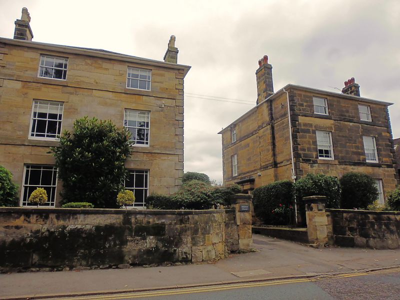
1. BORDYKE
1732
Nos 13 & 14
TQ 5946 NW 3/40A
II GV
2.
A pair of 3 storey early C19 houses built in ashlar. 2 windows, glazing
bars intact. Rusticated quoins, bands over ground and first floors.
Substantial stone stacks. Slate roofs. Facing entrances on return walls.
Simple porches with plain square pilasters and cornice.
Nos 9 to 14 (consec) form a group
Listing NGR: TQ5929446846
External links are from the relevant listing authority and, where applicable, Wikidata. Wikidata IDs may be related buildings as well as this specific building. If you want to add or update a link, you will need to do so by editing the Wikidata entry.


Other nearby listed buildings
