Approximate Location Map
Large Map »
Latitude: 51.1966 / 51°11'47"N
Longitude: 0.2762 / 0°16'34"E
OS Eastings: 559138
OS Northings: 146620
OS Grid: TQ591466
Mapcode National: GBR MP0.YFN
Mapcode Global: VHHQ6.Q5WZ
Plus Code: 9F3257WG+MF
Entry Name: 4-12, East Street
Listing Date: 20 January 1972
Grade: II
Source: Historic England
Source ID: 1363394
English Heritage Legacy ID: 178666
ID on this website: 101363394
Location: Tonbridge, Tonbridge and Malling, Kent, TN9
County: Kent
District: Tonbridge and Malling
Electoral Ward/Division: Medway
Parish: Non Civil Parish
Built-Up Area: Tonbridge
Traditional County: Kent
Lieutenancy Area (Ceremonial County): Kent
Church of England Parish: Tonbridge St Peter and St Paul
Church of England Diocese: Rochester
Tagged with: Building
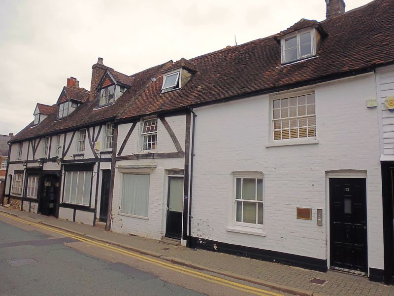
1. EAST STREET
1732 (North Side)
Nos 4 to 12 (even)
TQ 5946 NW 3/48A
II GV
2.
Row of C17 cottages subsequently brick faced. Nos 6, 8 and 10 have modern
imitation timbering applied to the first floor, with modern, large ground
floor windows to restaurant and shops. Nos 4 and 12 are plain, white
painted, with windows and glazing bars intact. Flat roofed dormers to
Nos 4, 6 and 8, and gabled dormers to No 10 and 12.
Nos 4 to 12 (even) and the Man of Kent Public House form a group
Listing NGR: TQ5912946621
External links are from the relevant listing authority and, where applicable, Wikidata. Wikidata IDs may be related buildings as well as this specific building. If you want to add or update a link, you will need to do so by editing the Wikidata entry.


Other nearby listed buildings
