Latitude: 51.3866 / 51°23'11"N
Longitude: -2.0535 / 2°3'12"W
OS Eastings: 396374
OS Northings: 165282
OS Grid: ST963652
Mapcode National: GBR 2TK.3MS
Mapcode Global: VHB47.CD8X
Plus Code: 9C3V9WPW+JJ
Entry Name: The Greyhound Inn
Listing Date: 3 April 1987
Grade: II
Source: Historic England
Source ID: 1365571
English Heritage Legacy ID: 311174
ID on this website: 101365571
Location: Bromham, Wiltshire, SN15
County: Wiltshire
Civil Parish: Bromham
Built-Up Area: Bromham
Traditional County: Wiltshire
Lieutenancy Area (Ceremonial County): Wiltshire
Church of England Parish: Bromham, Chittoe and Sandy Lane
Church of England Diocese: Salisbury
Tagged with: Inn
ST 9665 BROMHAM HIGH STREET (east side)
10/24 The Greyhound Inn
GV II
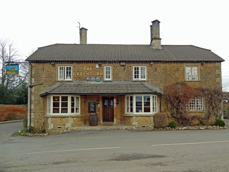
Inn, mid C19, squared ironstone rubble with ashlar dressings, slate half-hipped roof and paired diagonal stacks, one pair on ridge, one on rear wall. Two storeys, Tudor style with hoodmoulds to windows. Four-window range. To left, symmetrical 3-window sections with first floor centre casement and outer casement pairs, ground floor canted bays each side of centre door with slate hipped roof continued from bays over door. To right ground floor 3-light and first floor 2-light stone mullion windows with original iron small- paned casements. West end wall has casements each floor with hoodmoulds. Long rear range running north, largely rubble stone to road, red brick to east.
Listing NGR: ST9637965278
External links are from the relevant listing authority and, where applicable, Wikidata. Wikidata IDs may be related buildings as well as this specific building. If you want to add or update a link, you will need to do so by editing the Wikidata entry.


Other nearby listed buildings