Approximate Location Map
Large Map »
Latitude: 51.5389 / 51°32'19"N
Longitude: -0.0658 / 0°3'56"W
OS Eastings: 534240
OS Northings: 183990
OS Grid: TQ342839
Mapcode National: GBR Y2.CJ
Mapcode Global: VHGQT.TL35
Plus Code: 9C3XGWQM+GM
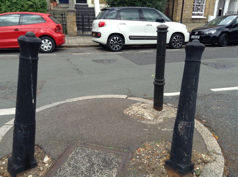
Entry Name: 3 Posts at Junction with Marlborough Avenue
Listing Date: 16 October 1973
Grade: II
Source: Historic England
Source ID: 1365740
English Heritage Legacy ID: 425992
ID on this website: 101365740
Location: Haggerston, Hackney, London, E8
County: London
District: Hackney
Electoral Ward/Division: London Fields
Parish: Non Civil Parish
Built-Up Area: Hackney
Traditional County: Middlesex
Lieutenancy Area (Ceremonial County): Greater London
Church of England Parish: St Michael and All Angels London Fields
Church of England Diocese: London
Tagged with: Building
SHRUBLAND ROAD E8
1.
5013 (North Side)
-----------------
3 Posts at junction with
Marlborough Avenue
TQ 3483 31/574 16.10.73.
II
2.
Group of 3 early-mid Cl9 cast iron gunposts in triangular formation around lamp
standard in middle of road.
Listing NGR: TQ3424083990
External links are from the relevant listing authority and, where applicable, Wikidata. Wikidata IDs may be related buildings as well as this specific building. If you want to add or update a link, you will need to do so by editing the Wikidata entry.


Other nearby listed buildings
