Approximate Location Map
Large Map »
Latitude: 52.6293 / 52°37'45"N
Longitude: -2.4529 / 2°27'10"W
OS Eastings: 369443
OS Northings: 303603
OS Grid: SJ694036
Mapcode National: GBR BX.7JTH
Mapcode Global: WH9DH.956M
Plus Code: 9C4VJGHW+PR
Entry Name: Lee Dingle Bridge
Listing Date: 8 April 1983
Grade: II
Source: Historic England
Source ID: 1367428
English Heritage Legacy ID: 361861
ID on this website: 101367428
Location: Blists Hill, Telford and Wrekin, Shropshire, TF7
County: Telford and Wrekin
Civil Parish: Madeley
Built-Up Area: Telford
Traditional County: Shropshire
Lieutenancy Area (Ceremonial County): Shropshire
Church of England Parish: Madeley
Church of England Diocese: Hereford
Tagged with: Bridge
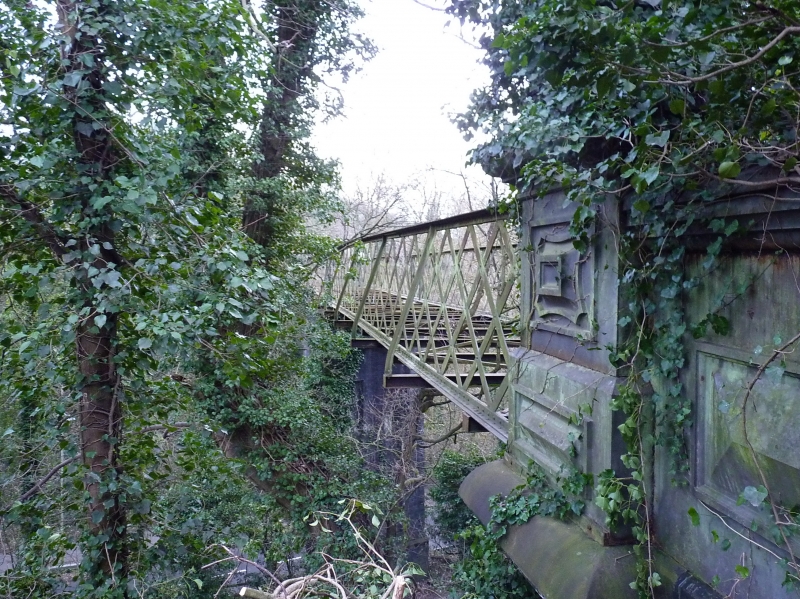
BLISTS HILL Lee Dingle Bridge
1.
5362
SJ 60 SE 33/3
II
2.
Built in 1872. A high level iron lattice girder bridge on 2 large blue engineering
brick piers, tapered and with parallel sides, bases and capitals. The abutments
at each end have cast-iron parapets. Built to connect Meadowpit Colliery via
Baggaleys Wind (an incline), to the Blists Hill Ironworks.
Listing NGR: SJ6944303603
External links are from the relevant listing authority and, where applicable, Wikidata. Wikidata IDs may be related buildings as well as this specific building. If you want to add or update a link, you will need to do so by editing the Wikidata entry.


Other nearby listed buildings
