Approximate Location Map
Large Map »
Latitude: 52.5973 / 52°35'50"N
Longitude: -2.5578 / 2°33'27"W
OS Eastings: 362317
OS Northings: 300093
OS Grid: SJ623000
Mapcode National: GBR BS.9H0C
Mapcode Global: WH9DF.PZ76
Plus Code: 9C4VHCWR+WW
Entry Name: 51-54, Sheinton Street
Listing Date: 1 February 1974
Grade: II
Source: Historic England
Source ID: 1367541
English Heritage Legacy ID: 254841
ID on this website: 101367541
Location: Much Wenlock, Shropshire, TF13
County: Shropshire
Civil Parish: Much Wenlock
Built-Up Area: Much Wenlock
Traditional County: Shropshire
Lieutenancy Area (Ceremonial County): Shropshire
Church of England Parish: Much Wenlock with Bourton
Church of England Diocese: Hereford
Tagged with: Building
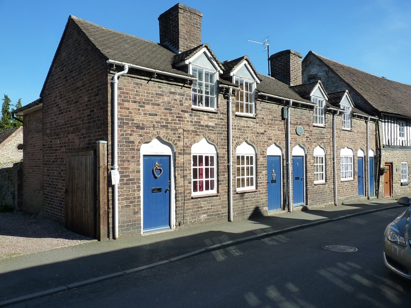
1.
1954 MUCH WENLOCK
SHEINTON STREET
(East Side)
Nos 51 to 54 (consec)
SJ 60 SW (SJ 6200) 6/81
II GV
2.
Circa 1800. A modest range of almshouses. 2 storeys; 4 leaded casement
windows above; 4 ditto below with plastered ogee heads; 4 ledged doors
with heads as above; brick eaves; old tiles.
Nos 50 to 59 form a group
Listing NGR: SJ6231700093
External links are from the relevant listing authority and, where applicable, Wikidata. Wikidata IDs may be related buildings as well as this specific building. If you want to add or update a link, you will need to do so by editing the Wikidata entry.


Other nearby listed buildings
