Approximate Location Map
Large Map »
Latitude: 52.6329 / 52°37'58"N
Longitude: -2.2881 / 2°17'17"W
OS Eastings: 380596
OS Northings: 303946
OS Grid: SJ805039
Mapcode National: GBR 079.Y23
Mapcode Global: WH9DK.T2LV
Plus Code: 9C4VJPM6+5Q
Entry Name: Barn About 60 Metres South East of the Elms
Listing Date: 26 September 1984
Grade: II
Source: Historic England
Source ID: 1367612
English Heritage Legacy ID: 255110
ID on this website: 101367612
Location: Albrighton, Shropshire, WV7
County: Shropshire
Civil Parish: Albrighton
Built-Up Area: Albrighton
Traditional County: Shropshire
Lieutenancy Area (Ceremonial County): Shropshire
Church of England Parish: Albrighton St Mary Magdalene
Church of England Diocese: Lichfield
Tagged with: Barn
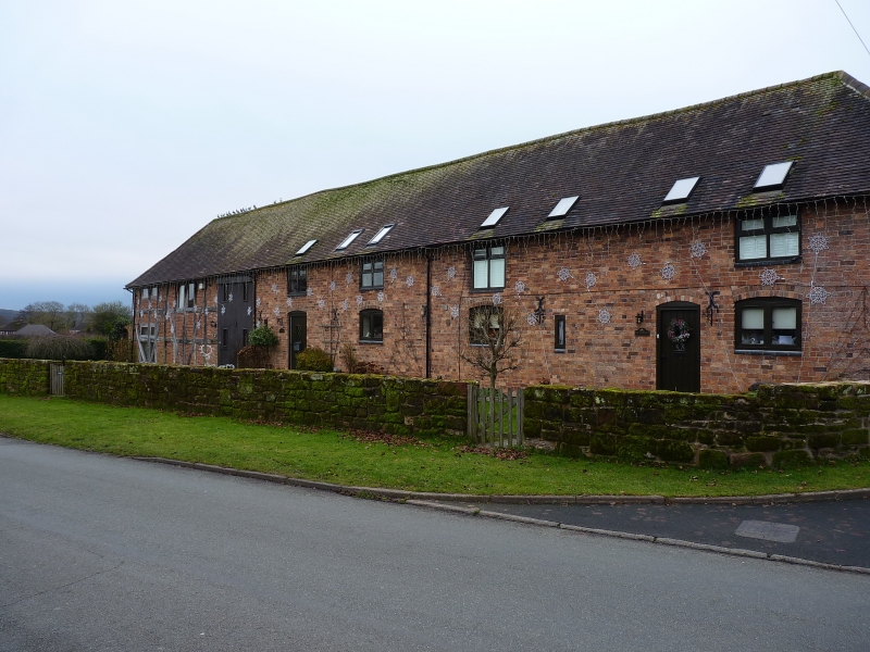
SJ 80 SW; 6/4
ALBRIGHTON C.P., ELM ROAD,
Barn about 60m south-east
of The Elms
G.V.
II
Barn. Probably C18. Timber-framed with red brick infilling and plain
tiled roof. Only a part of the original barn survives, three structural
bays with square panelling and long straight tension braces, wide entrance;
red brick extension (rebuilding?) to right with windows and first
floor entrance to hay loft.
Listing NGR: SJ8059603946
External links are from the relevant listing authority and, where applicable, Wikidata. Wikidata IDs may be related buildings as well as this specific building. If you want to add or update a link, you will need to do so by editing the Wikidata entry.


Other nearby listed buildings
