Latitude: 51.8565 / 51°51'23"N
Longitude: -1.5987 / 1°35'55"W
OS Eastings: 427736
OS Northings: 217626
OS Grid: SP277176
Mapcode National: GBR 5SB.JMM
Mapcode Global: VHBZM.7LPM
Plus Code: 9C3WVC42+JG
Entry Name: Hunters Lodge and Attached Barn
Listing Date: 19 December 1986
Grade: II
Source: Historic England
Source ID: 1368171
English Heritage Legacy ID: 251791
ID on this website: 101368171
Location: Shipton-under-Wychwood, West Oxfordshire, OX7
County: Oxfordshire
District: West Oxfordshire
Civil Parish: Shipton-under-Wychwood
Built-Up Area: Shipton under Wychwood
Traditional County: Oxfordshire
Lieutenancy Area (Ceremonial County): Oxfordshire
Church of England Parish: Shipton-under-Wychwood
Church of England Diocese: Oxford
Tagged with: Architectural structure
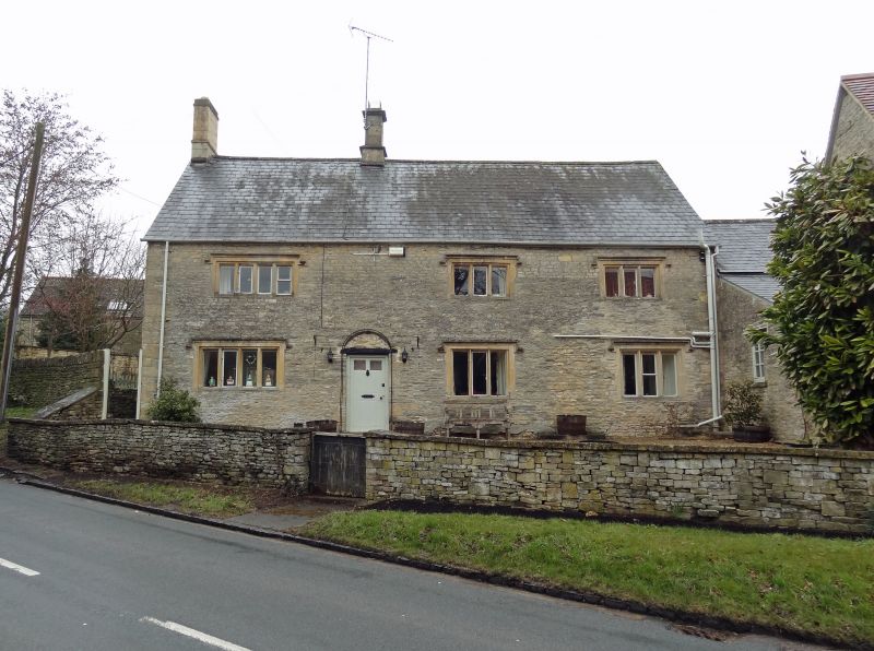
SHIPTON-UNDER-WYCHWOOD HIGH STREET SP 2617-2717 (west side) 7/77 Hunter's Lodge and - attached Barn II GV Farmhouse and barn. Late C17. Coursed rubble with slate roof. Two storeys and gable-lit attic; 1:2 windows, 4- and 3-light mullioned windows with drips; flush panel door to left of centre with arched metal hood. Lean-to to right links with C19 barn of 1:3 bays roofed in C20 red tiles, right-hand part with central entry and high up vents.
Listing NGR: SP2773617626
External links are from the relevant listing authority and, where applicable, Wikidata. Wikidata IDs may be related buildings as well as this specific building. If you want to add or update a link, you will need to do so by editing the Wikidata entry.


Other nearby listed buildings