Approximate Location Map
Large Map »
Latitude: 51.7628 / 51°45'46"N
Longitude: -1.2092 / 1°12'32"W
OS Eastings: 454675
OS Northings: 207425
OS Grid: SP546074
Mapcode National: GBR 8Z0.F3K
Mapcode Global: VHCXP.0Y3H
Plus Code: 9C3WQQ7R+48
Entry Name: Boundary Wall of Bury Knowle
Listing Date: 28 June 1972
Grade: II
Source: Historic England
Source ID: 1369406
English Heritage Legacy ID: 245700
ID on this website: 101369406
Location: Headington, Oxford, Oxfordshire, OX3
County: Oxfordshire
District: Oxford
Electoral Ward/Division: Headington
Parish: Non Civil Parish
Built-Up Area: Oxford
Traditional County: Oxfordshire
Lieutenancy Area (Ceremonial County): Oxfordshire
Church of England Parish: Headington St Andrew
Church of England Diocese: Oxford
Tagged with: Wall
NORTH PLACE
1.
1485
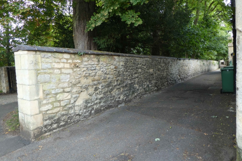
Boundary Wall
of Bury Knowle
SP 5407 18/59A
II
2.
Runs South from North Place gate to London Road and East along the frontage
of the park. Partly ancient rubble walling. The London Road length is C19.
Scenic value.
Listing NGR: SP5467507425
External links are from the relevant listing authority and, where applicable, Wikidata. Wikidata IDs may be related buildings as well as this specific building. If you want to add or update a link, you will need to do so by editing the Wikidata entry.


Other nearby listed buildings
