Latitude: 51.162 / 51°9'43"N
Longitude: 0.5531 / 0°33'11"E
OS Eastings: 578615
OS Northings: 143400
OS Grid: TQ786434
Mapcode National: GBR PSM.2N6
Mapcode Global: VHJN0.J2S2
Plus Code: 9F325H63+Q6
Entry Name: Oaks Farmhouse
Listing Date: 25 March 1987
Grade: II
Source: Historic England
Source ID: 1372044
English Heritage Legacy ID: 174598
ID on this website: 101372044
Location: Staplehurst, Maidstone, Kent, TN12
County: Kent
District: Maidstone
Civil Parish: Staplehurst
Built-Up Area: Staplehurst
Traditional County: Kent
Lieutenancy Area (Ceremonial County): Kent
Tagged with: Farmhouse
STAPLEHURST HIGH STREET TQ 7843 (East side)
5/132 Oaks Farmhouse
GV II
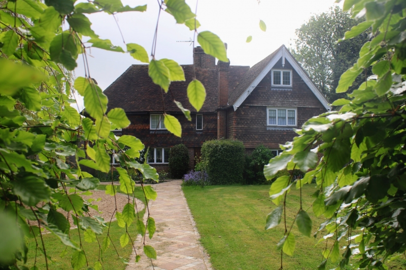
Farmhouse, now house. C17 or earlier, with mid C19 addition and facade. Timber framed. Ground floor red and grey brick in English bond, banded plain and fishscale tiles to first floor. Plain tile roof. Main range, with C19 cross-wing projecting forwards to right. 2 storeys and attic. Roof hipped to left. Wing gabled with plain bargeboards and pendant. Projecting brick stack to left gable end and multiple brick ridge stack towards junction of main range and wing. Slender projecting brick stack to long left side of wing. 2-light leaded attic casement to gable of wing. Irregular fenestration of 4 casements; one 3-light, one 2-light and one single-light to main range and one leaded 3-light to gable end of wing. Ribbed door to right end of main range, under stack. Rear lean-to. Interior not inspected.
Listing NGR: TQ7864743385
External links are from the relevant listing authority and, where applicable, Wikidata. Wikidata IDs may be related buildings as well as this specific building. If you want to add or update a link, you will need to do so by editing the Wikidata entry.


Other nearby listed buildings