Approximate Location Map
Large Map »
Latitude: 51.3429 / 51°20'34"N
Longitude: 0.3658 / 0°21'56"E
OS Eastings: 564871
OS Northings: 163079
OS Grid: TQ648630
Mapcode National: GBR NNQ.P9Q
Mapcode Global: VHJLY.9H7X
Plus Code: 9F3289V8+58
Entry Name: Harvel House
Listing Date: 26 July 1983
Grade: II
Source: Historic England
Source ID: 1372620
English Heritage Legacy ID: 356802
ID on this website: 101372620
Location: Harvel, Gravesham, Kent, DA13
County: Kent
District: Gravesham
Civil Parish: Meopham
Traditional County: Kent
Lieutenancy Area (Ceremonial County): Kent
Church of England Parish: Meopham St John the Baptist
Church of England Diocese: Rochester
Tagged with: House
TQ 66 SW MEOPHAM HARVEL LANE
7/73
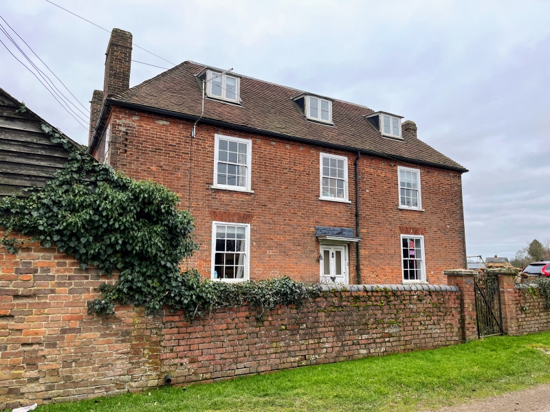
Harvel House
II
C17 "double pile" house. C18 3 bay red brick front. Chimneys at gable ends. Three sash windows with glazing bars.
Listing NGR: TQ6487163078
External links are from the relevant listing authority and, where applicable, Wikidata. Wikidata IDs may be related buildings as well as this specific building. If you want to add or update a link, you will need to do so by editing the Wikidata entry.


Other nearby listed buildings
