Latitude: 52.8931 / 52°53'35"N
Longitude: -1.15 / 1°9'0"W
OS Eastings: 457279
OS Northings: 333185
OS Grid: SK572331
Mapcode National: GBR 8JB.Q19
Mapcode Global: WHDH5.9JLY
Plus Code: 9C4WVRVX+6X
Entry Name: The Hermitage
Listing Date: 13 November 1986
Grade: II
Source: Historic England
Source ID: 1373895
English Heritage Legacy ID: 431175
ID on this website: 101373895
Location: Ruddington, Rushcliffe, Nottinghamshire, NG11
County: Nottinghamshire
District: Rushcliffe
Civil Parish: Ruddington
Built-Up Area: Ruddington
Traditional County: Nottinghamshire
Lieutenancy Area (Ceremonial County): Nottinghamshire
Church of England Parish: Ruddington
Church of England Diocese: Southwell and Nottingham
Tagged with: Architectural structure
SK 53 SE RUDDINGTON HIGH STREET (west side)
5/110 The Hermitage
G.V. II
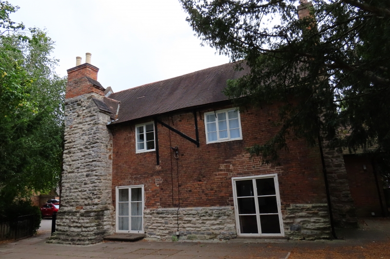
House, now church rooms, museum and flats. C16, remodelled 1708, late C18, and late C19 alterations and extensions. Red brick and rubble. Plain tile roof with brick coped left gable with kneelers. Large right external gable rubble stack with red brick shaft. Single similar larger stack on stepped plinth to front left. Deep rubble plinth. To left of the front stack is an eaves band and first floor band which extend to the left gable wall. 2 storeys plus cellar and garret, 2 bays. 2 doorways with glazed double doors. Above is a single casement with single tripartite casement to the right. Left gable wall with single blocked cellar opening. Above is a single tripartite casement with single blocked opening to the left and single similar casement above. In the garret is a single smaller casement with band extending over, under is an ashlar plaque inscribed "BFM 1708". At right angles to the rear of the main front is a late C18 wing with further C19 extensions to the rear. Interior has possible C16 stone fireplace with relieving arch over.
Listing NGR: SK5727933185
External links are from the relevant listing authority and, where applicable, Wikidata. Wikidata IDs may be related buildings as well as this specific building. If you want to add or update a link, you will need to do so by editing the Wikidata entry.


Other nearby listed buildings