Latitude: 53.7975 / 53°47'50"N
Longitude: -1.5883 / 1°35'17"W
OS Eastings: 427218
OS Northings: 433540
OS Grid: SE272335
Mapcode National: GBR B7L.GH
Mapcode Global: WHC9C.KTX5
Plus Code: 9C5WQCW6+XM
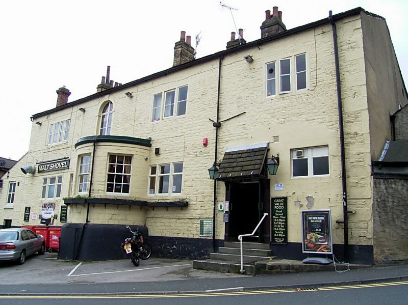
Entry Name: Malt Shovel Public House
Listing Date: 5 August 1976
Grade: II
Source: Historic England
Source ID: 1375242
English Heritage Legacy ID: 466124
ID on this website: 101375242
Location: Armley, Leeds, West Yorkshire, LS12
County: Leeds
Electoral Ward/Division: Armley
Parish: Non Civil Parish
Built-Up Area: Leeds
Traditional County: Yorkshire
Lieutenancy Area (Ceremonial County): West Yorkshire
Church of England Parish: Armley with New Wortley
Church of England Diocese: Leeds
Tagged with: Pub
LEEDS
SE2733 CRAB LANE, Armley 714-1/33/485 (North side) 05/08/76 No.21 Malt Shovel Public House
GV II
Formerly known as: No.23 Malt Shovel Public House BRANCH ROAD Armley. Public house. Late C18. Coursed stone, low-pitched stone slate roof. Quoins. 2 storeys, 3+1 bays. 2-light sashes in plain stone surrounds, single-light 1st-floor centre. Central door with overlight, cornice on console brackets. Left bay has blocked loading door and small window to 1st floor. Rebuilt stack right, 2 stacks rear of ridge centre and left. Rear: semicircular bay window with 3 sashes centre, keyed round arch to stair window above, 3, and 4-light mullioned windows, doorway right. INTERIOR: not inspected.
Listing NGR: SE2721833540
External links are from the relevant listing authority and, where applicable, Wikidata. Wikidata IDs may be related buildings as well as this specific building. If you want to add or update a link, you will need to do so by editing the Wikidata entry.


Other nearby listed buildings