Latitude: 53.7978 / 53°47'52"N
Longitude: -1.552 / 1°33'7"W
OS Eastings: 429606
OS Northings: 433591
OS Grid: SE296335
Mapcode National: GBR BHL.6C
Mapcode Global: WHC9D.4S6X
Plus Code: 9C5WQCXX+46
Entry Name: Numbers 11 and 12 and Attached Railings
Listing Date: 26 September 1963
Last Amended: 11 September 1996
Grade: II
Source: Historic England
Source ID: 1375391
English Heritage Legacy ID: 466287
ID on this website: 101375391
Location: Leeds, West Yorkshire, LS1
County: Leeds
Electoral Ward/Division: City and Hunslet
Parish: Non Civil Parish
Built-Up Area: Leeds
Traditional County: Yorkshire
Lieutenancy Area (Ceremonial County): West Yorkshire
Church of England Parish: Leeds St George
Church of England Diocese: Leeds
Tagged with: Building
LEEDS
SE2933NE PARK PLACE 714-1/75/287 (North side) 26/09/63 Nos.11 AND 12 and attached railings (Formerly Listed as: PARK PLACE (North side) Nos.11 AND 12)
GV II
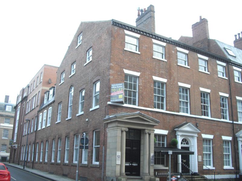
House, now 2 sets of offices, with area railings. Probably 1785-94 with later C20 alterations. By William Hargrave. Red brick, Flemish bond, stone details, slate roof, wrought-iron area railings, ashlar porch. 3 storeys, 5 bays. Central entrance (No.11) with panelled door, fanlight, in stone surround with three-quarter Tuscan columns supporting entablature, dentilled cornice and pediment. Added stone porch far left (No.12) has Ionic columns in antis and shallow moulded pediment. Sashes with glazing bars, restored, painted slightly cambered arches, stone sills, continuous sill band to 1st floor. Modillion eaves cornice, ridge stacks centre and right, forward of ridge. INTERIOR: not inspected. Area railings: bud finials to bars and standards. William Hargrave built at least 14 houses in Park Place on land leased from the Wilson estate; the properties were leased to the wealthy merchants who were leaving the congested town centre. (Beresford, M: East End, West End: Face of Leeds During Urbanisation 1684-1842: Leeds: 1988-).
Listing NGR: SE2960633591
External links are from the relevant listing authority and, where applicable, Wikidata. Wikidata IDs may be related buildings as well as this specific building. If you want to add or update a link, you will need to do so by editing the Wikidata entry.


Other nearby listed buildings