Approximate Location Map
Large Map »
Latitude: 53.1938 / 53°11'37"N
Longitude: -2.8736 / 2°52'25"W
OS Eastings: 341728
OS Northings: 366655
OS Grid: SJ417666
Mapcode National: GBR 7B.2Y6L
Mapcode Global: WH887.TZSG
Plus Code: 9C5V54VG+GG
Entry Name: Hoole Lane Lock
Listing Date: 23 July 1998
Grade: II
Source: Historic England
Source ID: 1375740
English Heritage Legacy ID: 469719
ID on this website: 101375740
Location: Boughton, Cheshire West and Chester, Cheshire, CH2
County: Cheshire West and Chester
Electoral Ward/Division: Boughton
Parish: Non Civil Parish
Built-Up Area: Chester
Traditional County: Cheshire
Lieutenancy Area (Ceremonial County): Cheshire
Church of England Parish: Chester St Paul
Church of England Diocese: Chester
Tagged with: Lock
CHESTER CITY (EM)
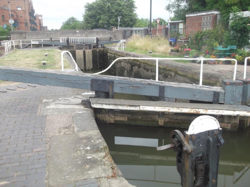
SJ4166 CHESTER CANAL
1932-1/6/39 Hoole Lane Lock
II
Canal lock. c1775. By Samuel Weston for Chester Canal Company
with later repairs. Red sandstone and brick. Pair of timber
upper gates east, repaired; pair of mid C20 steel lower gates.
Lock basin with stone copings and walls intact; replaced
footbridge; stone retaining wall to towpath; brick pavements.
Listing NGR: SJ4172866655
External links are from the relevant listing authority and, where applicable, Wikidata. Wikidata IDs may be related buildings as well as this specific building. If you want to add or update a link, you will need to do so by editing the Wikidata entry.


Other nearby listed buildings
