Latitude: 53.1888 / 53°11'19"N
Longitude: -2.8829 / 2°52'58"W
OS Eastings: 341101
OS Northings: 366108
OS Grid: SJ411661
Mapcode National: GBR 7B.3276
Mapcode Global: WH88F.P3CQ
Plus Code: 9C5V54Q8+GR
Entry Name: 20, 21 and 22, the Groves
Listing Date: 23 July 1998
Grade: II
Source: Historic England
Source ID: 1375943
English Heritage Legacy ID: 469922
ID on this website: 101375943
Location: Chester, Cheshire West and Chester, Cheshire, CH1
County: Cheshire West and Chester
Electoral Ward/Division: Chester City
Parish: Non Civil Parish
Built-Up Area: Chester
Traditional County: Cheshire
Lieutenancy Area (Ceremonial County): Cheshire
Church of England Parish: Chester St John the Baptist
Church of England Diocese: Chester
Tagged with: Building
CHESTER CITY (EM)
SJ4166 THE GROVES 1932-1/6/153 (North side) Nos.20, 21 AND 22
GV II
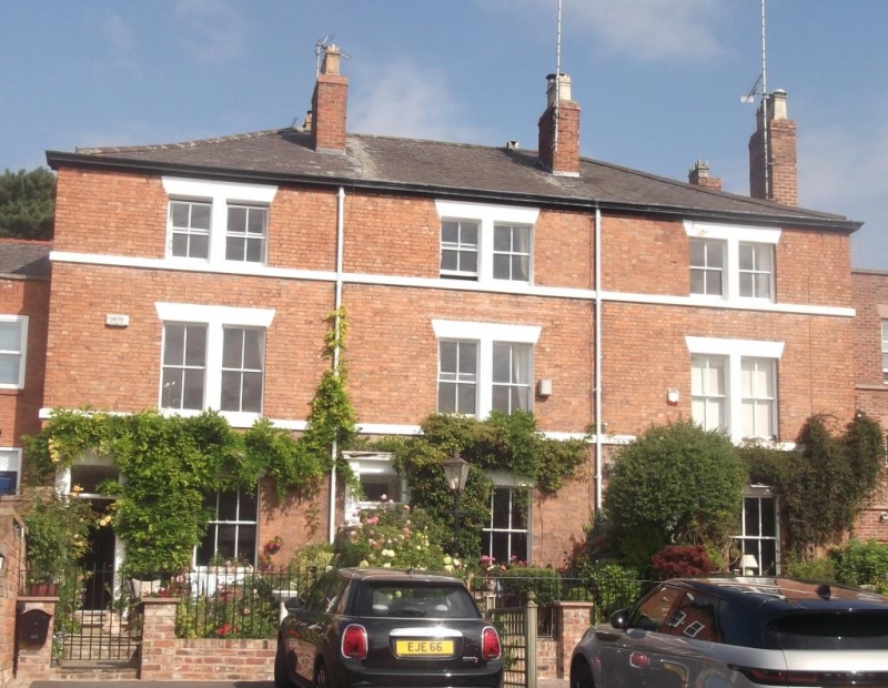
Row of 3 town houses c1840. Flemish bond orange brick; hipped grey slate roof. 3 storeys; 3 pairs of sashes; almost symmetrical. 4-panel doors with simple overlights in painted stone or artificial stone cases having cornices on boldly decorated brackets. One recessed sash with painted stone sill and wedge lintel to ground floor of each house. First floor sillband; a pair of recessed 4-pane sashes per house with wide flat mullion and wedge lintels; second floor sillband; pairs of 4-pane sashes, shorter than to first floor. 2 chimneys before and 2 behind ridge, plus 2 on right end. INTERIORS not inspected.
Listing NGR: SJ4110166108
External links are from the relevant listing authority and, where applicable, Wikidata. Wikidata IDs may be related buildings as well as this specific building. If you want to add or update a link, you will need to do so by editing the Wikidata entry.


Other nearby listed buildings