Latitude: 53.1909 / 53°11'27"N
Longitude: -2.8893 / 2°53'21"W
OS Eastings: 340677
OS Northings: 366352
OS Grid: SJ406663
Mapcode National: GBR 7B.2SSD
Mapcode Global: WH88F.L2B2
Plus Code: 9C5V54R6+97
Entry Name: Number 41 Street
Listing Date: 10 January 1972
Last Amended: 6 August 1998
Grade: II
Source: Historic England
Source ID: 1376241
English Heritage Legacy ID: 470235
ID on this website: 101376241
Location: Chester, Cheshire West and Chester, Cheshire, CH1
County: Cheshire West and Chester
Electoral Ward/Division: Chester City
Parish: Non Civil Parish
Built-Up Area: Chester
Traditional County: Cheshire
Lieutenancy Area (Ceremonial County): Cheshire
Church of England Parish: Chester, St Peter
Church of England Diocese: Chester
Tagged with: Building
CHESTER CITY (IM)
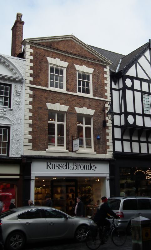
SJ4066SE EASTGATE STREET AND ROW 595-1/4/165 (North side) 10/01/72 No.41 Street (Formerly Listed as: EASTGATE STREET No.41)
GV II
Shop with accommodation, now storage. Probably mid C18, altered. Flemish bond stone-dressed brown brickwork; grey slate roof with ridge at right angle to street. Modern shopfront of no interest. Rusticated second-storey floor-band of painted stone; rusticated quoins to second and third storeys; 2 altered cross-windows with painted stone sills and wedge lintels with false keystones to second storey; third storey sillband and 2 flush 9-pane unequal sashes; modillion pediment; brown brick lateral chimney, west. INTERIOR not inspected.
Listing NGR: SJ4067766352
External links are from the relevant listing authority and, where applicable, Wikidata. Wikidata IDs may be related buildings as well as this specific building. If you want to add or update a link, you will need to do so by editing the Wikidata entry.


Other nearby listed buildings