Approximate Location Map
Large Map »
Latitude: 51.4852 / 51°29'6"N
Longitude: -0.1064 / 0°6'22"W
OS Eastings: 531580
OS Northings: 177946
OS Grid: TQ315779
Mapcode National: GBR NP.8S
Mapcode Global: VHGR0.3XMV
Plus Code: 9C3XFVPV+3F
Entry Name: 10, Kennington Park Place
Listing Date: 5 November 1999
Grade: II
Source: Historic England
Source ID: 1379427
English Heritage Legacy ID: 478810
ID on this website: 101379427
Location: Newington, Southwark, London, SE11
County: London
District: Southwark
Electoral Ward/Division: Newington
Parish: Non Civil Parish
Built-Up Area: Southwark
Traditional County: Surrey
Lieutenancy Area (Ceremonial County): Greater London
Church of England Parish: Kennington Park St Agnes
Church of England Diocese: Southwark
Tagged with: Building
TQ3177 KENNINGTON PARK PLACE No. 10
636-1/9/10018
GV II
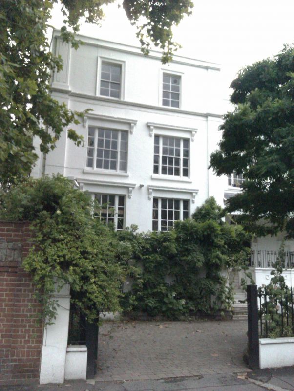
House and coach house, later office and flats. North western part built between 1805 and 1810, south eastern part was added probably circa 1820 with attached former coach house also of circa 1820. Stuccoed building with slate roof, mansard to south eastern part.
EXTERIOR: North western part of three storeys and semi-basement; two windows. Parapet, bands between floors and end pilasters with incised Greek key design. Second floor has 8-pane sashes with panes laid horizontally in moulded architraves. First floor has tripartite sashes of 20 panes with cornice and bracket. Ground floor has taller 25-pane tripartite sashes and cast iron balconette with trellis pattern. Semi-basement has left side 16-pane sash and one blank. Rear elevation has parapet and 12-pane sashes.
South eastern part is set back, of three storeys of lower height with matching parapet and pilaster with Greek key design. One original window but narrow later C19 window to left hand side. Second floor round-headed blank and narrow later C19 sash without glazing bars. First floor has tripartite sash of 16 panes and narrow later C19 sash without glazing bars to left side. Ground floor has grand entrance underwooden canopy with wooden Doric half-columns. Doorcase with semi-circular fanlight, pilasters and original door with six octagonal panels, the two upper panels glazed. Two curved flights of stone steps have blank niches and central elaborate cast iron balustrading on base with blank round-headed arch with impost blocks and wreaths. Rear elevation has full-height curved bow of three bays with parapet, panels above top floor windows and sash windows.
Attached former coach house to south east is of two storeys with deep cornice, pilasters, 16-pane sash to first floor and double doors and pedestrian entrance to ground floor.
INTERIOR: Not inspected. HISTORY: The street was originally called St Agnes Place and houses were built between 1805 and 1810. The North western part is shown on Horwood's map of 1814. The whole building including the former coach house is shown on a print in "The Illustrated London News" of 1857 showing the Hustings at Kennington.
Listing NGR: SP5156002229
External links are from the relevant listing authority and, where applicable, Wikidata. Wikidata IDs may be related buildings as well as this specific building. If you want to add or update a link, you will need to do so by editing the Wikidata entry.


Other nearby listed buildings
