Approximate Location Map
Large Map »
Latitude: 51.2082 / 51°12'29"N
Longitude: -2.6479 / 2°38'52"W
OS Eastings: 354833
OS Northings: 145640
OS Grid: ST548456
Mapcode National: GBR MN.42ZG
Mapcode Global: VH89S.2W0P
Plus Code: 9C3V6952+7R
Entry Name: 57, High Street
Listing Date: 13 September 1972
Grade: II
Source: Historic England
Source ID: 1382990
English Heritage Legacy ID: 483407
ID on this website: 101382990
Location: Wells, Somerset, BA5
County: Somerset
District: Mendip
Civil Parish: Wells
Built-Up Area: Wells
Traditional County: Somerset
Lieutenancy Area (Ceremonial County): Somerset
Tagged with: Building
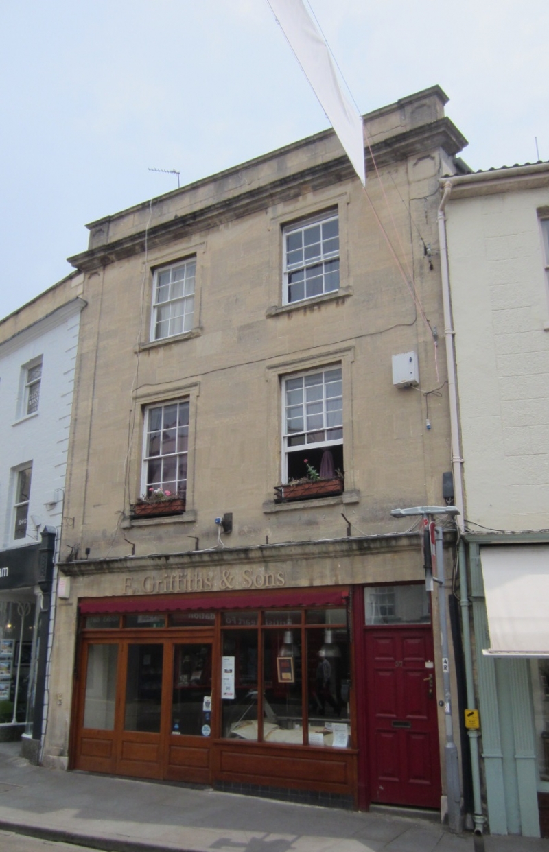
WELLS
ST5445 HIGH STREET
662-1/7/127 (South side)
13/09/72 No.57
GV II
Shop with house. Early C19. Doulting stone ashlar, roof not
visible behind parapet, brick chimney stack.
EXTERIOR: 3 storeys, 2 bays. Panelled pilasters, moulded
cornice, plain parapet. Simple shop front across ground floor,
with left-hand door, green marble stall riser, and
6-fielded-panel door to right. To upper floors are 12-pane
sash windows set in moulded eared architraves.
INTERIOR: ground floor adopted for shop.
Listing NGR: ST5483345640
External links are from the relevant listing authority and, where applicable, Wikidata. Wikidata IDs may be related buildings as well as this specific building. If you want to add or update a link, you will need to do so by editing the Wikidata entry.


Other nearby listed buildings
