Approximate Location Map
Large Map »
Latitude: 52.4907 / 52°29'26"N
Longitude: -2.6963 / 2°41'46"W
OS Eastings: 352817
OS Northings: 288315
OS Grid: SO528883
Mapcode National: GBR BL.J4XG
Mapcode Global: VH83K.6NXH
Plus Code: 9C4VF8R3+7F
Entry Name: Temple 160 Metres East of Millichope Park
Listing Date: 15 March 1974
Grade: II*
Source: Historic England
Source ID: 1383366
English Heritage Legacy ID: 483784
ID on this website: 101383366
Location: Beambridge, Shropshire, SY7
County: Shropshire
Civil Parish: Munslow
Traditional County: Shropshire
Lieutenancy Area (Ceremonial County): Shropshire
Church of England Parish: Munslow
Church of England Diocese: Hereford
Tagged with: Architectural structure
MUNSLOW
SO58NW MILLICHOPE PARK
1312-1/11/166 Temple 160 metres east of Millichope
15/03/74 Park
GV II*
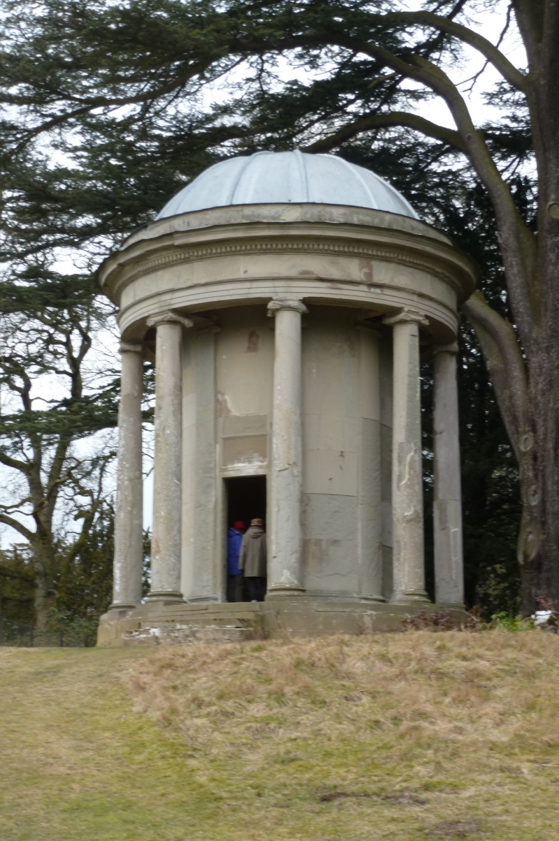
Memorial temple. Dated 1770. By George Steuart. Built as
cenotaph for the More family. Ashlar with leaded domed roof.
EXTERIOR: cylindrical structure set on a circular stylobate,
with 8 Ionic pilasters surrounded by 8 Ionic columns
supporting a plain entablature, moulded dentil cornice and
leaded dome. 6-panelled entrance door in plain surround
between pilasters with inscribed and dated plaque over.
INTERIOR: moulded skirting, dado, cornice and coffered dome.
Inscribed pedestal memorial surmounted with statue of winged
cherub and globe on vase commemorating L More d.1744 and J
More d.1763.
Temple forms an eyecatching focus across a picturesque
landscape of cliff-face, lake and lawn from the front of
Millichope Park (qv).
Listing NGR: SO5281788315
External links are from the relevant listing authority and, where applicable, Wikidata. Wikidata IDs may be related buildings as well as this specific building. If you want to add or update a link, you will need to do so by editing the Wikidata entry.


Other nearby listed buildings
