Approximate Location Map
Large Map »
Latitude: 51.4103 / 51°24'36"N
Longitude: -2.4946 / 2°29'40"W
OS Eastings: 365697
OS Northings: 168030
OS Grid: ST656680
Mapcode National: GBR JV.QK6M
Mapcode Global: VH88W.QT28
Plus Code: 9C3VCG64+45
Entry Name: Dapp's Hill Bridge
Listing Date: 27 February 1950
Grade: II
Source: Historic England
Source ID: 1384611
English Heritage Legacy ID: 485046
ID on this website: 101384611
Location: Keynsham, Bath and North East Somerset, Somerset, BS31
County: Bath and North East Somerset
Civil Parish: Keynsham
Built-Up Area: Keynsham
Traditional County: Somerset
Lieutenancy Area (Ceremonial County): Somerset
Tagged with: Bridge
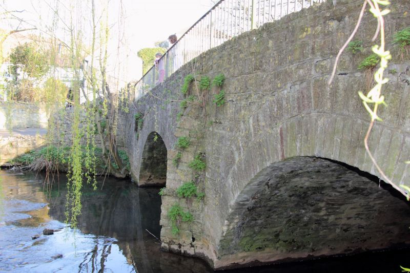
KEYNSHAM
ST6568 DAPP'S HILL
739-1/4/36 (East side)
27/02/50 Dapp's Hill Bridge
GV II
Bridge spanning the River Chew. Late C17 with late C20
alteration. Coursed rubble and some dressed stone to
buttresses and arches. 2 segmental arches with centre
buttress-cutwaters set diagonally. Late C20 metal handrails to
each side. Forms a group with Nos 1-8 (consecutive) Chew
Cottages, Dapp's Hill (qqv).
Listing NGR: ST6569768030
External links are from the relevant listing authority and, where applicable, Wikidata. Wikidata IDs may be related buildings as well as this specific building. If you want to add or update a link, you will need to do so by editing the Wikidata entry.


Other nearby listed buildings
