Approximate Location Map
Large Map »
Latitude: 51.4683 / 51°28'5"N
Longitude: -0.0911 / 0°5'28"W
OS Eastings: 532685
OS Northings: 176101
OS Grid: TQ326761
Mapcode National: GBR RW.PT
Mapcode Global: VHGR6.CCP7
Plus Code: 9C3XFW95+8G
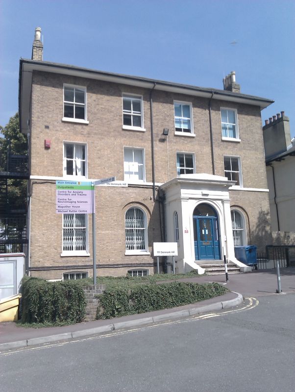
Entry Name: 111, Denmark Hill
Listing Date: 17 September 1998
Grade: II
Source: Historic England
Source ID: 1385463
English Heritage Legacy ID: 470861
ID on this website: 101385463
Location: Camberwell, Southwark, London, SE5
County: London
District: Southwark
Electoral Ward/Division: Brunswick Park
Parish: Non Civil Parish
Built-Up Area: Southwark
Traditional County: Surrey
Lieutenancy Area (Ceremonial County): Greater London
Church of England Parish: Camberwell St Giles with St Matthew
Church of England Diocese: Southwark
Tagged with: Building
SOUTHWARK
TQ3276 DENMARK HILL
636-1/11/279 (East side)
No.111
GV II
House. Early to mid C19. Brick in Flemish bond with hipped
roof of slate.
3 storeys over basement and 4-window range. Round-arched
openings to ground-floor with entrance in 3rd-window range set
under an enclosed prostyle porch. First-floor sill band.
Upper-floor windows flat-arched with gauged brick lintels.
Stacks to returns. Broad, boxed eaves.
INTERIOR: not inspected.
Listing NGR: TQ3268576101
External links are from the relevant listing authority and, where applicable, Wikidata. Wikidata IDs may be related buildings as well as this specific building. If you want to add or update a link, you will need to do so by editing the Wikidata entry.


Other nearby listed buildings
