Latitude: 51.4705 / 51°28'13"N
Longitude: -0.0717 / 0°4'18"W
OS Eastings: 534030
OS Northings: 176376
OS Grid: TQ340763
Mapcode National: GBR XW.11
Mapcode Global: VHGR6.P9ZK
Plus Code: 9C3XFWCH+58
Entry Name: 34, Elm Grove
Listing Date: 27 September 1972
Grade: II
Source: Historic England
Source ID: 1385516
English Heritage Legacy ID: 470915
ID on this website: 101385516
Location: Peckham, Southwark, London, SE15
County: London
District: Southwark
Electoral Ward/Division: The Lane
Parish: Non Civil Parish
Built-Up Area: Southwark
Traditional County: Surrey
Lieutenancy Area (Ceremonial County): Greater London
Church of England Parish: Peckham All Saints
Church of England Diocese: Southwark
Tagged with: Building
SOUTHWARK
TQ3476 ELM GROVE 636-1/12/330 (North side) 27/09/72 No.34
GV II
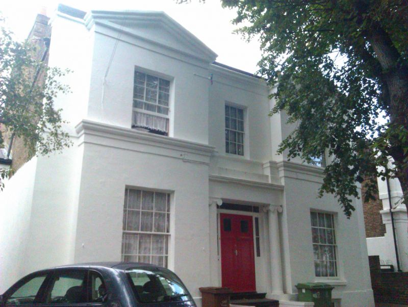
Detached villa. c1836. Stucco with cornice and blocking course. Double-fronted. 2 storeys and basement, 3 bays with 1 storey, 1 window extension to left. Outer windows are in slightly projecting bays with pediments and cornices. Entrance flanked by Ionic columns supporting entablature has recessed door with margin lights and plain oblong overlight. Sash windows with glazing bars in stucco lined reveals, those on ground floor with margin lights, the central one on 1st floor in slightly recessed bay. Wide, moulded 1st-floor sill string. INTERIOR: not inspected.
Listing NGR: TQ3403076375
External links are from the relevant listing authority and, where applicable, Wikidata. Wikidata IDs may be related buildings as well as this specific building. If you want to add or update a link, you will need to do so by editing the Wikidata entry.


Other nearby listed buildings