Latitude: 51.4796 / 51°28'46"N
Longitude: -0.0719 / 0°4'18"W
OS Eastings: 533988
OS Northings: 177393
OS Grid: TQ339773
Mapcode National: GBR WR.ZR
Mapcode Global: VHGR6.P2VJ
Plus Code: 9C3XFWHH+V6
Entry Name: Willowbrook Urban Studies Centre
Listing Date: 27 September 1972
Last Amended: 17 September 1998
Grade: II
Source: Historic England
Source ID: 1386050
English Heritage Legacy ID: 471471
Also known as: Willowbrook Road No.48
ID on this website: 101386050
Location: Peckham, Southwark, London, SE15
County: London
District: Southwark
Electoral Ward/Division: Livesey
Parish: Non Civil Parish
Built-Up Area: Southwark
Traditional County: Surrey
Lieutenancy Area (Ceremonial County): Greater London
Church of England Parish: Peckham St John with Andrew
Church of England Diocese: Southwark
Tagged with: Architectural structure
SOUTHWARK
TQ3377 WILLOWBROOK ROAD
636-1/10/863 (South side)
27/09/72 No.48
Willowbrook Urban Studies Centre
(Formerly Listed as:
WILLOWBROOK ROAD
No.48)
II
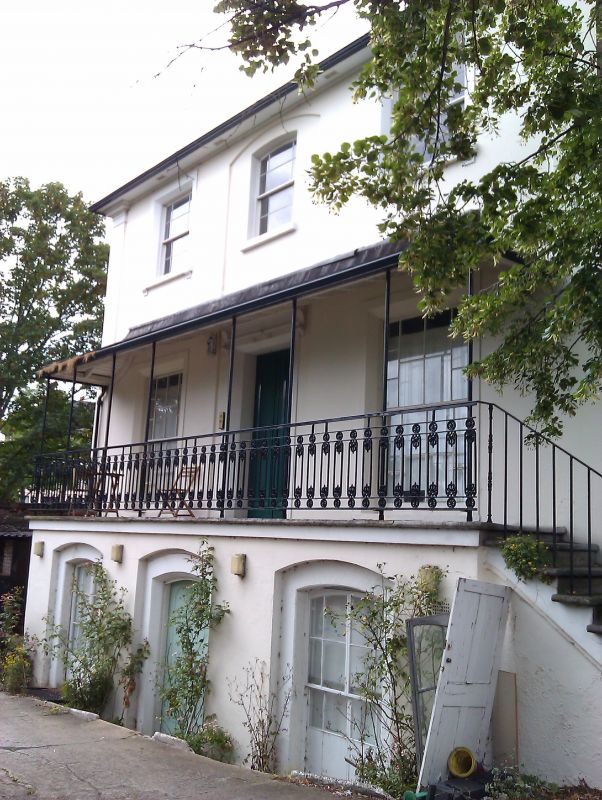
House, now a college. c1840. Stucco with low-pitched hipped,
slate roof.
2 storeys and basement, 3 windows; side on to road. Basement
projects in front, providing ground-floor loggia with lead
canopy and decorative cast-iron rail. Central door with stucco
architrave and console bracketed cornice. Giant angle
pilasters. Sash windows with margin lights have stucco
architraves and bracketed sills and canted reveals, except
1st-floor central window and basement openings which are
segmental-headed in segmental-arched recesses.
INTERIOR: not inspected.
Listing NGR: TQ3398877393
External links are from the relevant listing authority and, where applicable, Wikidata. Wikidata IDs may be related buildings as well as this specific building. If you want to add or update a link, you will need to do so by editing the Wikidata entry.


Other nearby listed buildings