Latitude: 53.5148 / 53°30'53"N
Longitude: -2.269 / 2°16'8"W
OS Eastings: 382257
OS Northings: 402049
OS Grid: SD822020
Mapcode National: GBR DC3.D1
Mapcode Global: WHB98.3XSB
Plus Code: 9C5VGP7J+W9
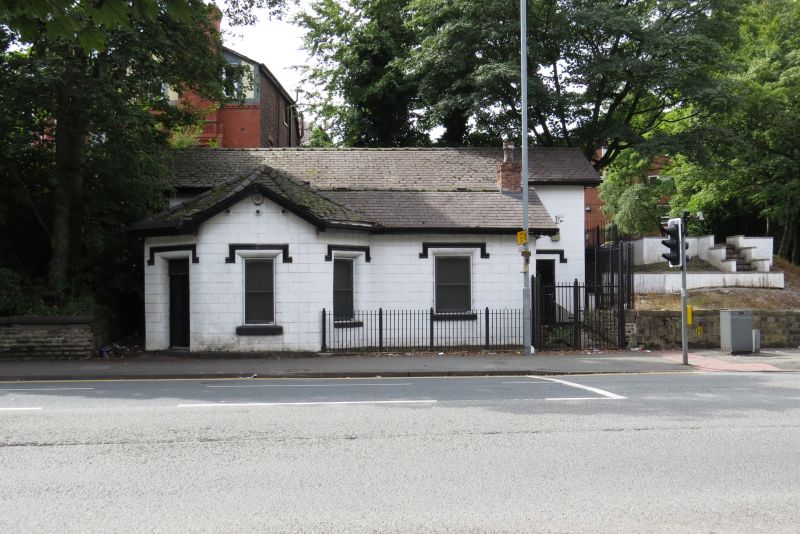
Entry Name: Former Kersal Bar Toll House
Listing Date: 18 January 1980
Grade: II
Source: Historic England
Source ID: 1386102
English Heritage Legacy ID: 471526
ID on this website: 101386102
Location: Broughton Park, Salford, Greater Manchester, M7
County: Salford
Electoral Ward/Division: Kersal
Parish: Non Civil Parish
Built-Up Area: Salford
Traditional County: Lancashire
Lieutenancy Area (Ceremonial County): Greater Manchester
Church of England Parish: Kersal Moor St Paul
Church of England Diocese: Manchester
Tagged with: House
SALFORD
SD80SW BURY NEW ROAD 949-1/2/28 (West side) 18/01/80 Former Kersal Bar Toll House
II
Former toll house, latterly in use as shop, but now disused. Early C19. Stucco over brick with slate roof felted over, and stack on right hand side. Single-storey, octagonal single-unit plan with additional rectangular bay to right. Entrance to left, windows in gable facing street and to right, both replaced but with original drop-ended hoodmoulds over. INTERIOR not inspected. Probably the only surviving toll house in the Manchester and Salford area.
Listing NGR: SD8225702049
External links are from the relevant listing authority and, where applicable, Wikidata. Wikidata IDs may be related buildings as well as this specific building. If you want to add or update a link, you will need to do so by editing the Wikidata entry.


Other nearby listed buildings