Latitude: 50.3675 / 50°22'3"N
Longitude: -4.1369 / 4°8'12"W
OS Eastings: 248120
OS Northings: 54141
OS Grid: SX481541
Mapcode National: GBR RC6.FJ
Mapcode Global: FRA 2872.6EP
Plus Code: 9C2Q9V97+26
Entry Name: 54, Southside Street
Listing Date: 25 January 1954
Last Amended: 9 November 1998
Grade: II
Source: Historic England
Source ID: 1386409
English Heritage Legacy ID: 473795
ID on this website: 101386409
Location: Barbican, Plymouth, Devon, PL1
County: City of Plymouth
Electoral Ward/Division: St Peter and the Waterfront
Parish: Non Civil Parish
Built-Up Area: Plymouth
Traditional County: Devon
Lieutenancy Area (Ceremonial County): Devon
Tagged with: Building
PLYMOUTH
SX4854SW SOUTHSIDE STREET, Barbican 740-1/62/72 (South side) 25/01/54 No.54 (Formerly Listed as: SOUTHSIDE STREET, Plymouth No.54)
GV II
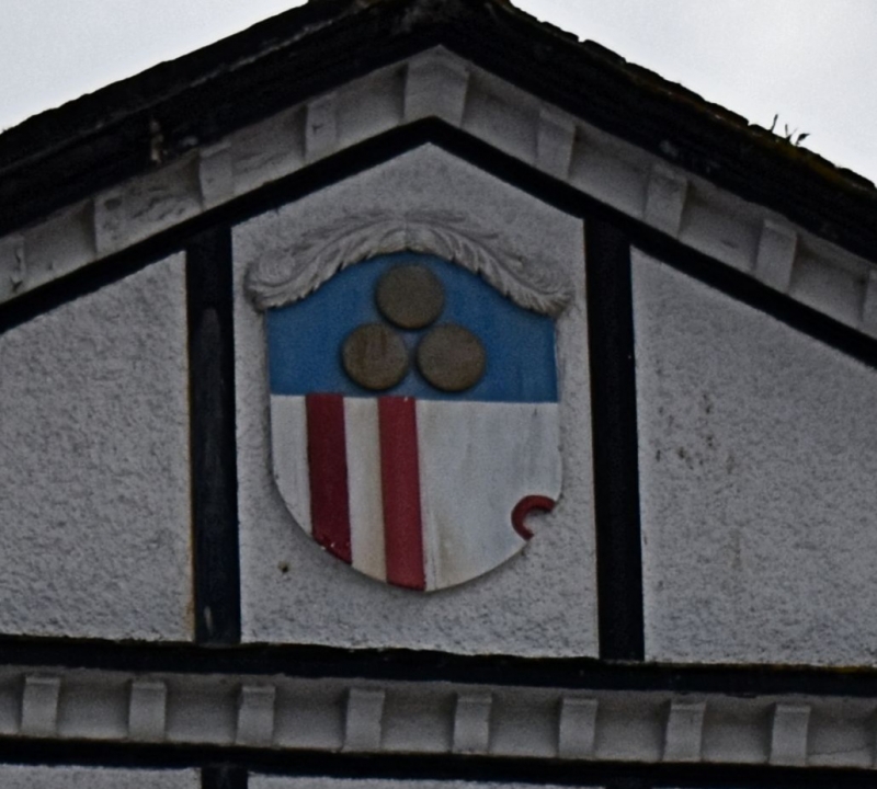
Merchant's house. C17, remodelled in the C18. Rendered brick front with applied mock timber framing; slate roof with low-pitched triangular pediment with modillion cornice and acroteria at the front; central coat of arms and ball finials of acroteria of reused old materials; lateral brick stack on the right and a massive central rendered rubble and brick stack. Fairly deep plan. 4 storeys; 3-window range. Original 12-pane hornless sashes with thick glazing bars. Ground floor has slightly bowed C20 shopfront set back from the front. INTERIOR: not inspected but former list description notes large carved wooden fireplace dated 1680 and small C18 staircase with turned balusters and column newels. (The Buildings of England: Pevsner N: Devon: London: 1989-: 663).
Listing NGR: SX4812054141
External links are from the relevant listing authority and, where applicable, Wikidata. Wikidata IDs may be related buildings as well as this specific building. If you want to add or update a link, you will need to do so by editing the Wikidata entry.


Other nearby listed buildings