Latitude: 50.3643 / 50°21'51"N
Longitude: -4.1417 / 4°8'30"W
OS Eastings: 247773
OS Northings: 53789
OS Grid: SX477537
Mapcode National: GBR RBF.S6
Mapcode Global: FRA 2862.Q8T
Plus Code: 9C2Q9V75+P8
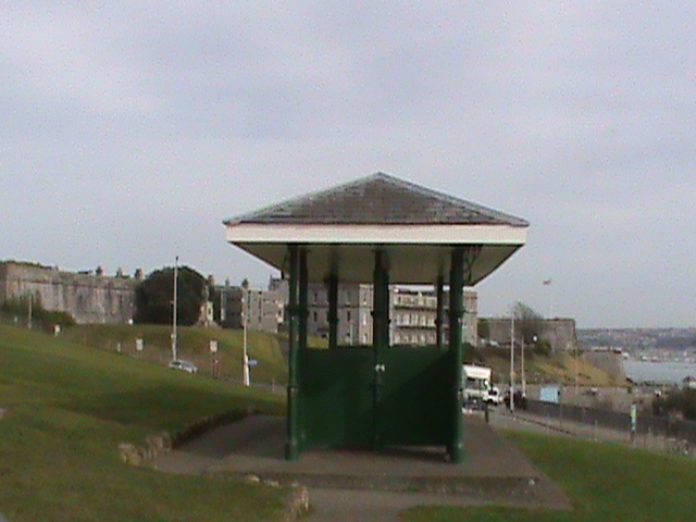
Entry Name: Shelter by Smeatons Tower, the Promenade
Listing Date: 9 November 1998
Grade: II
Source: Historic England
Source ID: 1386447
English Heritage Legacy ID: 473834
ID on this website: 101386447
PLYMOUTH
SX4753 THE HOE, Hoe 740-1/66/297 Shelter by Smeaton's Tower, The Promenade
GV II
Shelter in public park. Late C19. Cast-iron frame with wooden partitions and seats; hipped dry slate roof with deep projecting eaves. Rectangular plan with recessed seat on each side. The roof is carried on central column at either end and 4 pairs of slender turned and carved columns with arabesque brackets to decorated frieze. Slatted seats on ornate cast-iron supports. Boarded ceiling. One of a good group of garden buildings on the Hoe, extended and replanned in the 1880s. (The Buildings of England: Pevsner N: Devon: London: 1989-: 665).
Listing NGR: SX4777353789
External links are from the relevant listing authority and, where applicable, Wikidata. Wikidata IDs may be related buildings as well as this specific building. If you want to add or update a link, you will need to do so by editing the Wikidata entry.


Other nearby listed buildings