Latitude: 51.8988 / 51°53'55"N
Longitude: -2.0737 / 2°4'25"W
OS Eastings: 395027
OS Northings: 222254
OS Grid: SO950222
Mapcode National: GBR 2M4.Y9T
Mapcode Global: VHB1Q.0JLQ
Plus Code: 9C3VVWXG+GG
Entry Name: Numbers 6 to 11 and Attached Railings
Listing Date: 12 March 1955
Grade: II
Source: Historic England
Source ID: 1386770
English Heritage Legacy ID: 474169
ID on this website: 101386770
Location: Cheltenham, Gloucestershire, GL50
County: Gloucestershire
District: Cheltenham
Electoral Ward/Division: College
Parish: Non Civil Parish
Built-Up Area: Cheltenham
Traditional County: Gloucestershire
Lieutenancy Area (Ceremonial County): Gloucestershire
Church of England Parish: Cheltenham, St Mary with St Matthew
Church of England Diocese: Gloucester
Tagged with: Building
CHELTENHAM
SO9522SW CAMBRAY PLACE 630-1/14/221 (North side) 12/03/55 Nos.6-11 (Consecutive) and attached railings
GV II
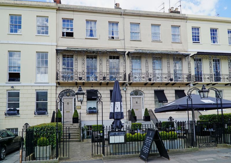
Terrace of 6 houses (now houses, flats and commercial buildings) with attached railings. Numbered right to left, described left to right. c1810-30: most of the terrace shown on the Post Office Map of 1820 (with a possible gap to east, Nos 6 and 7), all shown on Merrett's 1834 map. Railings supplied by W Wheeler; balustrades manufactured by Carron Company. Brick with stucco facades and slate roof; iron verandahs (except to No.11) and forecourt railings throughout. Double depth plan with service ranges to rear. EXTERIOR: 3 storeys with basement, 18 first-floor windows (3 per house). Stucco detailing includes: rustication to ground floor drawn into voussoirs over openings; floor bands; frieze, cornice and blocking course. Basement, first and second floors have 6/6 sashes, taller to first floor; 1/1 replacement sashes to ground floor; all in plain reveals and with sills. Entrances (3 to left, 3 to right): flights of steps to 5- and 6-panel doors between pilaster strips and side-lights with wide fanlights with batwing-and-circle glazing. INTERIOR: not inspected, but some shutters visible. SUBSIDIARY FEATURES: first-floor verandahs to all except No.11 have heart-and-anthemion motif to balustrades, probably supplied by W Wheeler who supplied the railings to Nos 6-9 (name on urn finials); area railings throughout have stick balusters and lattice panels, some reset; spearhead railings to sides of steps and between plots, some with anthemion finials to street. Ground-floor window boxes to No.10 have scroll motif. HISTORICAL NOTE: Cambray Place was a wide avenue leading to Cambray House, at one time rented to the Duke of Wellington but since demolished and replaced by a mid-C20 block of flats. (The Buildings of England: Verey D: Gloucestershire: The Vale and The Forest of Dean: London: 1992-: 145; Chatwin A: Cheltenham's Ornamental Ironwork: Cheltenham: 1975-1984: 37; Radford S: The Terraced Houses of Cheltenham 1800-1850: 1992-: 40-48; Merrett HS: Plan of the Town of Cheltenham: 1834-).
Listing NGR: SO9501622241
External links are from the relevant listing authority and, where applicable, Wikidata. Wikidata IDs may be related buildings as well as this specific building. If you want to add or update a link, you will need to do so by editing the Wikidata entry.


Other nearby listed buildings